Near Camden in Kershaw County, South Carolina — The American South (South Atlantic)
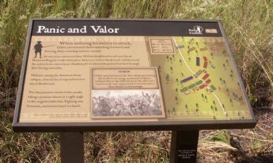
Panic and Valor
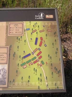
He therefore instructed Gen. William Smallwood to advance his 1st Maryland Brigade to take their place. However, before Smallwood could proceed, the militia broke into retreat. Smallwood’s Continentals pushed forward through their fleeing comrades.
Webster, seeing the American front collapse, wheeled his troops leftward to attack Smallwood.
The Marylanders checked this assault, taking a position almost at a right angle to the original battle line. Fighting was ferocious, sometimes hand-to-hand.
Erected by The Palmetto Conservation Foundation. (Marker Number 7.)
Topics. This historical marker is listed in this topic list: War, US Revolutionary.
Location. 34° 21.449′ N, 80° 36.544′ W. Marker is near Camden, South Carolina, in Kershaw County. Marker can be reached from Flat Rock Road (State Highway 58). 6.2 miles North of Camden off US 521 and 601 on SC 58. Touch for map. Marker is in this post office area: Camden SC 29020, United States of America. Touch for directions.
Other nearby markers. At least 8 other markers are within walking distance of this marker. The Road to Battle (within shouting distance of this marker); Contest with the Continentals (about 300 feet away, measured in a direct line); The Armies March to Camden (about 300 feet away); Baron DeKalb (about 400 feet away); Revolutionary War Patriots (about 400 feet away in South carolina); Battle of Camden (about 400 feet away); Camden Battlefield (about 500 feet away); Defeat in the Center (about 600 feet away). Touch for a list and map of all markers in Camden.
More about this marker. This marker is part of an interpretive trail series at the Battle of Camden National Historic Landmark.

Photographed By Anna Inbody, October 2, 2011
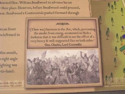
3. Picture on the marker
“(There was) haziness in the Air, which, preventing the smoke from rising, occasioned so thick a darkness that it was difficult to see the effect of a very heavy & well-supported fire on both sides.” Gen. Charles, Lord Cornwallis
“Battle of the Waxhaws, May 29th, 1780”, Harpers Weekly, May 29, 1858, courtesy of South Caroliniana Library, USC, Columbia (SC)
Credits. This page was last revised on June 16, 2016. It was originally submitted on October 9, 2011, by Anna Inbody of Columbia, South Carolina. This page has been viewed 545 times since then and 13 times this year. Photos: 1, 2, 3, 4. submitted on October 9, 2011, by Anna Inbody of Columbia, South Carolina. • Craig Swain was the editor who published this page.


