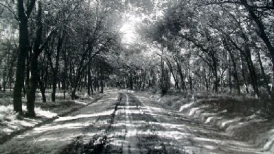
Beatrice in Gage County, Nebraska — The American Midwest (Upper Plains)
Veterans Memorial Drive
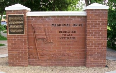
Dedicated to All Veterans
Originally dedicated 1934
Rededicated 2000
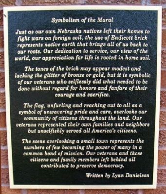
Symbolism of the Mural
Just as our own Nebraska natives left their homes to fight wars on foreign soil, the use of Endicott brick represents native earth that brings all of us back to our roots. Our dedication to service, our view of the world, our appreciation for life is rooted in home soil.
The tones of the brick may appear modest and lacking the glitter of bronze or gold, but it is symbolic of our veterans who selflessly did what needed to be done without regard for honors and fanfare of their courage and sacrifice.
The flag, unfurling and reaching out to all as a symbol of unwavering pride and care, overlooks our community of citizens throughout the land. Our veterans represented their own families and neighbors but unselfishly served all America's citizens.
The scene overlooking a small town represents the numbers of few becoming the power of many in a common bond of mission. Our veterans and those citizens and family members left behind all contributed to preserve democracy.
Written by Lynn Danielson
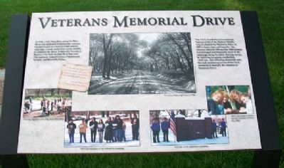
Veterans Memorial Drive
In 1934, a mile long drive along the Blue River was dedicated to honor war veterans. Funded in part as a federal relief project, sixty men a week worked for seven months to complete the drive. It officially became a Beatrice City Park on June 26 of that year. This parkway helped connect Chautauqua, Nichols, and Riverside Parks.
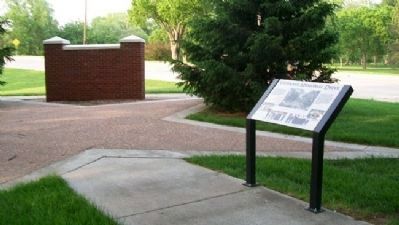
The Y.E.S. (Youth for Environmental Success) Club of the Beatrice Middle School adopted the Memorial Drive in 1997 to keep clean and beautify. The 100-year flood of 1992 and the 1996 tornado had damaged and destroyed much of the landscape along the drive. Raising money by applying for grants, conducting clean-ups, and collecting aluminum cans the club members purchased this brick memorial to beautify the entrance of Memorial Drive.
In the war on depression it seems most fitting to dedicate such a project to the veterans of all wars.....
Harold Mattoon
Project Chairman, 1934
Topics. This historical marker is listed in these topic lists: Charity & Public Work • Patriots & Patriotism • Roads & Vehicles. A significant historical month for this entry is June 1900.
Location. 40° 15.292′ N, 96° 44.803′ W. Marker is in Beatrice, Nebraska, in Gage County. Marker is on 6th Street (U.S. 77) near Veterans Memorial Drive, on the right when traveling south. Marker is at Beatrice Veterans Memorial Park. Touch for map. Marker is at or near this postal address: 1050 South 6th Street, Beatrice NE 68310, United States of America. Touch for directions.
Other nearby markers. At least 8 other markers are within walking distance of this marker. Fighting Communism - Korea and the Cold War (a few steps from this marker); World War I (a few steps from this marker); War Efforts at Home (within shouting distance of this marker); Beatrice's Own - Company C 134th Infantry Regiment Nebraska National Guard (within shouting distance of this marker); Containing Communism - The Berlin and Cuban Crises and Vietnam (within shouting distance of this marker); Freedom Fighters (within shouting distance of this marker); Beatrice's Own - Civil War and the Spanish-American War (within shouting distance of this marker); World War II (within shouting distance of this marker). Touch for a list and map of all markers in Beatrice.
Credits. This page was last revised on November 27, 2020. It was originally submitted on October 12, 2011, by William Fischer, Jr. of Scranton, Pennsylvania. This page has been viewed 681 times since then and 11 times this year. Photos: 1, 2, 3, 4, 5, 6. submitted on October 12, 2011, by William Fischer, Jr. of Scranton, Pennsylvania.
