Near McFarland in Dane County, Wisconsin — The American Midwest (Great Lakes)
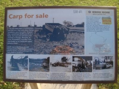
Carp for sale
Small carp under three pounds became animal feed at fish hatcheries and fur farms, or were plowed into farm fields as fertilizer.
Know More about gefillte fish
New York fish dealers were major buyers of Wisconsin carp. Ashkenazi Jewish communities in eastern cities such as New York ate gefillte fish, often made from carp. Fish Camp shipped many tons of Kegonsa and Waubesa carp for gefellte fish, a poached ball or patty made of deboned and ground fish. Other important markets are shown on the map below. [Map shows McFarland Fish Camp, with arrows to the north and west labeled "restaurants, families (fresh), fish hatcheries (canned), furbearer farms (feed), farms (fertilizer)"; an arrow to the southwest labeled "Omaha (fresh fish), Iowa (recreational fishing)"; an arrow to the south labeled "Illinois (recreational fishing)"; and an arrow to the southeast labeled "Chicago, Louisville, New York (fresh fish)"]
[Caption for lower left photo:] By 1957, carp and other non-game fish could be unloaded into Fish Camp's holding pond more efficiently. No longer did fish have to be hand-netted onto a wooden slide.
[Caption for second photo from left on bottom:] Workers fed corn (stored in the Corn House) to carp in the holding ponds. Ponds were enclosed by boards driven into the bottom of the river.
[Caption for third photo from left on bottom:] A loading tower at Fish Camp speeded up carp shipments, as shown here in 1959. Though McFarland carp were marketed nationally, Fish Camp also sold to local buyers.
[Caption for fourth photo from left on bottom:] The recipe for canning carp was 150 gallons of fiah and 60 pounds of flour, heated to 180 degrees. The first cannery was at Nevin Fish Hatchery in Madison.
[Caption for lower right photo:] An Illinois company loads carp in 1959. Carp from Madison lakes were sold to small buyers in southern Wisconsin and neighboring states.
All photos courtesy of Wisconsin Department of Natural Resources.
Erected by Dane County Parks.
Topics. This historical marker is listed in this topic list: Industry & Commerce. A significant historical year for this entry is 1957.
Location. 42° 58.946′ N, 89° 15.853′ W. Marker is near McFarland, Wisconsin, in Dane County. Marker can be reached from Fish Camp Road, 0.4 miles east of
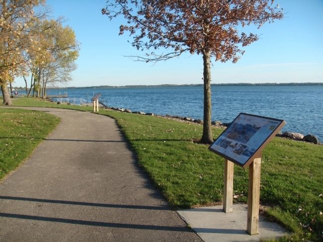
County Highway AB, on the right when traveling east. The marker is along the lakeshore path in Fish Camp Park. Touch for map. Marker is at or near this postal address: 3383 Fish Camp Road, Mc Farland WI 53558, United States of America. Touch for directions.
Other nearby markers. At least 8 other markers are within 3 miles of this marker, measured as the crow flies. Seasons of Fish Camp (a few steps from this marker); Too many carp (a few steps from this marker); All about nets (within shouting distance of this marker); How to catch 30,000 carp (within shouting distance of this marker); Working at Fish Camp (about 300 feet away, measured in a direct line); Fish Camp Launch (about 400 feet away); Village of McFarland (approx. 2˝ miles away); Robert Marion La Follette, Sr. (approx. 2˝ miles away). Touch for a list and map of all markers in McFarland.
Credits. This page was last revised on June 16, 2016. It was originally submitted on October 16, 2011, by William J. Toman of Green Lake, Wisconsin. This page has been viewed 784 times since then and 17 times this year. Photos: 1, 2. submitted on October 16, 2011, by William J. Toman of Green Lake, Wisconsin.

