Near Louisa in Louisa County, Virginia — The American South (Mid-Atlantic)
Clayton's Store
Sheridan's Camp
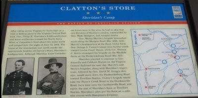
After riding across Virginia for three days on a raid to destroy parts of the Virginia Central Railroad, Gen. Philip H. Sheridan's 9,300 cavalrymen and horse artillerists crossed the North Anna River at Carpenter's Ford about two miles north and camped here the night of June 10, 1864. The house at the intersection just north marks the approximate location of Clayton's Store, Sheridan's headquarters. Although Sheridan knew Confederate forces were in the area, he had no idea that two divisions of cavalry, commanded by Gen. Wade Hampton, had camped nearby
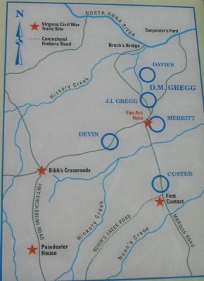
Gen. Wesley Merritt's brigade bivouacked south along the Marquis Road (Rte. 669), with Merritt's headquarters at the Buck Chiles farm. Gen. George A. Custer's camps were farther south toward Louisa Court House, while Col. Thomas C. Devin encamped his brigade on the Woolfolk Farm on the Fredericksburg Road (Rte. 613).
Sheridan planned to continue to Gordonsville and Cobham Station on the Virginia Central Railroad the next day. Merritt's and Devin's brigades, along with Sheridan's wagon train, followed by Gen. David M. Gregg's division, would move down the Fredericksburg Road toward Trevilian Station. Custer's brigade would take the Nunn's Creek Road to the Gordonsville Road, turn west onto the Gordonsville Road, and rejoin the rest of Sheridan's force at Trevilian Station. Sheridan's plan put his force on a collision course with Hampton's divisions.
Erected by Virginia Civil War Trails.
Topics and series. This historical marker is listed in this topic list: War, US Civil. In addition, it is included in the Virginia Civil War Trails series list. A significant historical date for this entry is June 10, 1870.
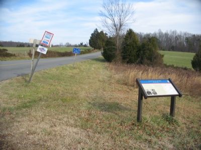
Location. 38° 5.698′ N, 77° 59.903′ W. Marker is near Louisa, Virginia, in Louisa County. Marker is at the intersection of Ellisville Drive (County Route 669) and Oakland Road (County Route 613), on the right when traveling north on Ellisville Drive. Located at pull off at the intersection, stop three on the self guided driving tour of the battlefield. Touch for map. Marker is in this post office area: Louisa VA 23093, United States of America. Touch for directions.
Other nearby markers. At least 8 other markers are within 5 miles of this marker, measured as the crow flies. Bibb's Crossroads (approx. 2.8 miles away); First Contact (approx. 3.6 miles away); Netherland Tavern (approx. 4.4 miles away); Decisive Confederate Victory (approx. 4.6 miles away); Oakland Cemetery (approx. 4.6 miles away); Trevilians Schoolhouse (approx. 4.8 miles away); Michie House (approx. 4.8 miles away); Louisa Rail Road track--1837 (approx. 4.8 miles away). Touch for a list and map of all markers in Louisa.
More about this marker. On the lower left the marker displays portraits of Gens. Wesley Merritt and Thomas Devin. A map on the right details the camp sites of the Federal units described in the text.
Regarding Clayton's Store. This is one of several markers interpreting the Battle of Trevilian Station, June 11-12, 1864. See the Battle of Trevilian Station Virtual Tour by Markers linked below for additional related markers.
Also see . . . Trevilian Station Battlefield Foundation. The foundation has worked to preserve the remaining sections of the battlefield. A detailed self-guided driving tour of the battlefield is offered. This marker is at stop three of the tour. (Submitted on January 20, 2008, by Craig Swain of Leesburg, Virginia.)
Photographed By Craig Swain, January 12, 2008
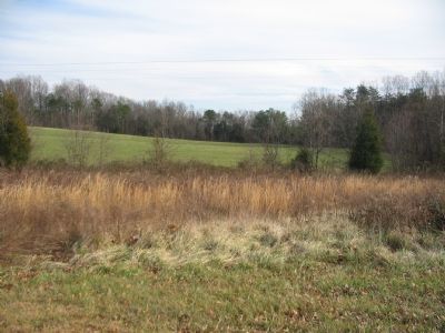
4. Merritt's Bivouack Area
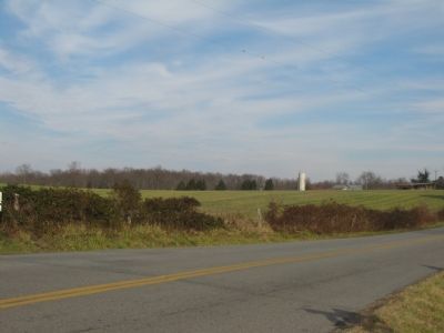
To the east of the marker's location Merritt's brigade rested on the night of June 10. Many have faulted Sheridan and his commanders for failing to post proper security or scout in front of his line of march for enemy threats. Anyone familiar with Civil War history will note, this wasn't the first or last time Sheridan did this. Nor for that matter was Sheridan the only Civil War commander with this problem.
Credits. This page was last revised on March 20, 2022. It was originally submitted on January 20, 2008, by Craig Swain of Leesburg, Virginia. This page has been viewed 2,204 times since then and 54 times this year. Photos: 1, 2, 3. submitted on January 20, 2008, by Craig Swain of Leesburg, Virginia. 4, 5. submitted on January 21, 2008, by Craig Swain of Leesburg, Virginia.
