Topeka in Shawnee County, Kansas — The American Midwest (Upper Plains)
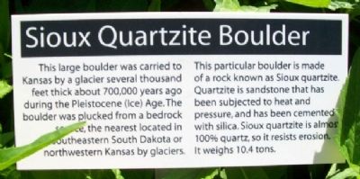
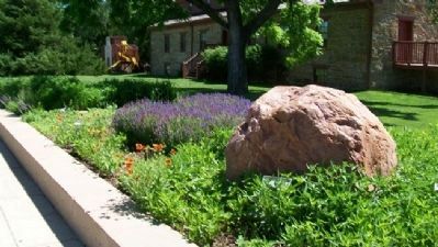
Sioux Quartzite Boulder
This large boulder was carried to Kansas by a glacier several thousand feet thick about 700,000 years ago during the Pleistocene (Ice) Age. The boulder was plucked from a bedrock source, the nearest located in southeastern South Dakota or northwestern Kansas by glaciers.
This particular boulder is made of a rock known as Sioux quartzite. Quartzite is sandstone that has been subjected to heat and pressure, and has been cemented with silica. Sioux quartzite is almost 100% quartz, so it resists erosion. It weighs 10.4 tons.
Erected by Kansas Historical Society.
Topics. This historical marker is listed in this topic list: Environment.
Location. 39° 3.376′ N, 95° 46.501′ W. Marker is in Topeka, Kansas, in Shawnee County. Marker and boulder are near the entrance to the Kansas Museum of History. Touch for map. Marker is at or near this postal address: 6425 SW 6th Avenue, Topeka KS 66615, United States of America. Touch for directions.
Other nearby markers. At least 8 other markers are within 3 miles of this marker, measured as the crow flies. Potawatomie Baptist Manual Labor Training School (within shouting distance of this marker); Mission Kitchen Garden (within shouting distance of this marker); Trails across Kansas (within shouting distance of this marker); Gettysburg Address (approx. 2.1 miles away); Veterans Memorial (approx. 2.3 miles away); Martin Luther (approx. 2˝ miles away); The Munn Pioneer Memorial (approx. 2.6 miles away); V. F. W. Lawn (approx. 2.7 miles away). Touch for a list and map of all markers in Topeka.
Also see . . . Sioux Quartzite. Wikipedia entry (Submitted on January 24, 2021, by Larry Gertner of New York, New York.)
Credits. This page was last revised on March 2, 2022. It was originally submitted on October 23, 2011, by William Fischer, Jr. of Scranton, Pennsylvania. This page has been viewed 684 times since then and 25 times this year. Photos: 1, 2. submitted on October 23, 2011, by William Fischer, Jr. of Scranton, Pennsylvania.

