Camden in Kershaw County, South Carolina — The American South (South Atlantic)
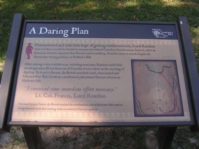
A Daring Plan
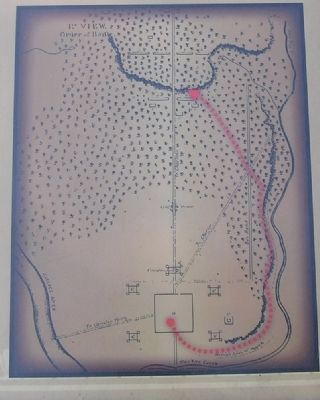
After arming every available man, including musicians, Rawdon could field almost 950 men. He led them out of Camden at ten o’clock on the morning of April 25. To deceive Greene, the British marched south, then turned and followed Pine Tree Creek on a northward path toward Greene’s forces on Hobkirk’s Hill.
“I conceived some immediate effort necessary.” Lt. Col. Francis, Lord Rawdon
Screened by pine forest, the British reached the southeastern end of Hobkirk’s Hill without being detected until their leading units encountered Greene’s pickets.
Topics. This historical marker is listed in this topic list: War, US Revolutionary.
Location. 34° 15.862′ N, 80° 35.912′ W. Marker is in Camden, South Carolina, in Kershaw County. Marker is on Kirkwood Road, on the left when traveling north. Marker is at "Kirkwood Commons". Touch for map. Marker is in this post office area: Camden SC 29020, United States of America. Touch for directions.
Other nearby markers. At least 8 other markers are within walking distance of this marker. Capt. Robert Kirkwood (1756-1791) (approx. 0.2 miles away); Battle of Hobkirk's Hill (approx. 0.2 miles away); The American Army (approx. ¼ mile away); The Battle of Hobkirk Hill (approx. ¼ mile away); The British Army (approx. ¼ mile away); The British Attack (approx. ¼ mile away); William Washington's Ride (approx. 0.4 miles away); Battle Of Hobkirk Hill (approx. 0.4 miles away). Touch for a list and map of all markers in Camden.
Credits. This page was last revised on June 16, 2016. It was originally submitted on October 24, 2011, by Anna Inbody of Columbia, South Carolina. This page has been viewed 662 times since then and 17 times this year. Photos: 1, 2, 3. submitted on October 24, 2011, by Anna Inbody of Columbia, South Carolina. • Craig Swain was the editor who published this page.


