Paducah in McCracken County, Kentucky — The American South (East South Central)
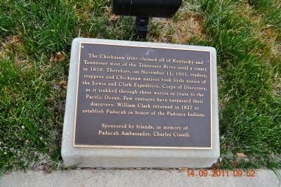
Chickasaw Tribe in Kentucky
Erected by ponsored by friends, in memory of Paducah Ambassador, Charles Cissell.
Topics. This historical marker is listed in these topic lists: Exploration • Native Americans • Settlements & Settlers. A significant historical date for this entry is November 11, 1803.
Location. 37° 5.285′ N, 88° 35.643′ W. Marker is in Paducah, Kentucky, in McCracken County. Marker is on South Water Street south of Broadway Street, on the left when traveling south. Touch for map. Marker is at or near this postal address: 117 S Water Street, Paducah KY 42001, United States of America. Touch for directions.
Other nearby markers. At least 8 other markers are within walking distance of this marker. Woodland and Mississippian Indians (here, next to this marker); First County Seat - Braxton Small (here, next to this marker); Iced Solid - Clear to Illinois! (here, next to this marker); Historic River Front (a few steps from this marker); Paleo and Archaic Indians (a few steps from this marker); Marine Ways (a few steps from this marker); Visitors Coming to Paducah (a few steps from this marker); Federal Occupation of Paducah (a few steps from this marker). Touch for a list and map of all markers in Paducah.
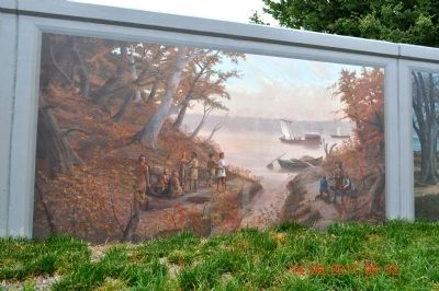
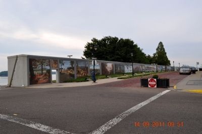
Also see . . . The Paducah Wall to Wall Floodwall Mural Project. Renowned artist Robert Dafford and his team of muralists capture Paducah’s rich history in paintings on the city’s floodwall overlooking the confluence of the Ohio and Tennessee Rivers. (Submitted on October 25, 2011.)
Credits. This page was last revised on June 16, 2016. It was originally submitted on October 24, 2011, by Sandra Hughes Tidwell of Killen, Alabama, USA. This page has been viewed 1,773 times since then and 111 times this year. Photos: 1, 2, 3. submitted on October 24, 2011, by Sandra Hughes Tidwell of Killen, Alabama, USA. • Bernard Fisher was the editor who published this page.


