Cheriton in Northampton County, Virginia — The American South (Mid-Atlantic)
Stratton Manor
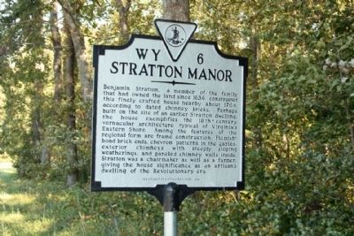
Photographed by Mike Stroud, October 15, 2011
1. Stratton Manor Marker
Erected 1998 by Department of Historic Resources. (Marker Number WY-6.)
Topics and series. This historical marker is listed in this topic list: Notable Buildings. In addition, it is included in the Virginia Department of Historic Resources (DHR) series list. A significant historical year for this entry is 1636.
Location. 37° 18.589′ N, 75° 57.704′ W. Marker is in Cheriton, Virginia, in Northampton County. It is on Charles M Lankford Memorial Highway (U.S. 13) near Cobbs
this page online

Regionally, this marker is on the Eastern Shore. It is also in the American South, specifically in the Upper South, on the Delmarva Peninsula, in the Tidewater, and on the Eastern Seaboard. Globally, it is in the North Atlantic Region, North America, the Western Hemisphere, the Western World, and the Anglosphere. Historically, it finds itself in what was once the territory of the Mississippian Culture, one of the original Thirteen Colonies, one of the Confederate States of America, and the Antebellum South.
Other nearby markers. At least 8 other markers are within 4 miles of this marker, measured as the crow flies: Salem Methodist Church (a few steps from this marker); Eyre Hall (within shouting distance of this marker); Site of Tidewater Institute (approx. ¾ mile away); Town Fields (approx. 1.2 miles away); Home of First Settler (approx. 2.8 miles away); Home of the First Settler (approx. 2.8 miles away); Eastville Inn (approx. 3.1
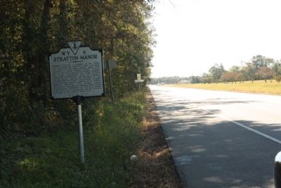
Photographed by Mike Stroud, October 15, 2011
2. Stratton Manor Marker, looking south along Charles M Lankford Memorial Highway
Another marker is no longer nearby. Towne Fields (was approx. 1.2 miles away but has been reported to have been replaced with another marker now near it).
Credits. This page was last revised on June 16, 2016. It was originally submitted on October 29, 2011, by Mike Stroud of Bluffton, South Carolina. This page has been viewed 2,371 times since then and 146 times this year. Photos: 1, 2. submitted on October 29, 2011, by Mike Stroud of Bluffton, South Carolina.
