
Satellite Beach in Brevard County, Florida — The American South (South Atlantic)
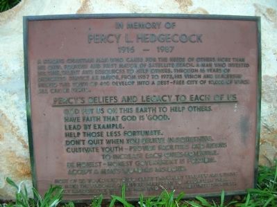
In Memory of Percy L. Hedgecock
1916 - 1987
Photographed by Julie Szabo, August 30, 2008
1. Percy L. Hedgecock Marker
Percy's beliefs and legacy to each of us:
God put us on this earth to help others.Most of us would like to do great things, but very few are willing to make the personal sacrifices necessary to accomplish them. Percy L. Hedgecock was one man who gladly made these sacrifices.
Have faith that God is good.
Lead by example.
Help those less fortunate.
Don't quit when you believe in something.
Cultivate youth - provide facilities and means to increase each one's potential.
Be honest - honest government is possible.
Accept a man's word as his bond.
Topics. This historical marker is listed in these topic lists: Government & Politics • Religion & Religious Structures. A significant historical year for this entry is 1957.
Location. 28° 10.291′ N, 80° 36.27′ W.
this page online

Regionally, this marker is in Florida’s Space Coast. It is also in the American South and on the Eastern Seaboard. Globally, it is in the North Atlantic Region, North America, a Gulf of Mexico state, the Western Hemisphere, the Western World, and the Anglosphere. Historically, it finds itself in what was once New Spain, the territory of the Mississippian Culture, one of the Confederate States of America, and the Antebellum South.
Other nearby markers. At least 8 other markers are within 3 miles of this marker, measured as the crow flies: Winter-Time Ais Indian Town of Pentoaya (approx. 2 miles away); The Freedom Tree (approx. 2.6 miles away); The Flavor of Freedom (approx. 2.6 miles away); Vietnam Veterans Memorial (approx.
Photographed by Julie Szabo, August 30, 2008
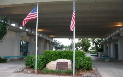
2. Percy L. Hedgecock Marker
Photographed by Julie Szabo, August 30, 2008
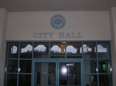
3. Satellite Beach City Hall
Credits. This page was last revised on November 10, 2019. It was originally submitted on November 19, 2008, by Julie Szabo of Oldsmar, Florida. This page has been viewed 1,758 times since then and 39 times this year. Last updated on October 30, 2011, by Jamie Cox of Melbourne, Florida. Photos: 1, 2, 3. submitted on November 19, 2008, by Julie Szabo of Oldsmar, Florida. • Kevin W. was the editor who published this page.
