Near Chippawa in Niagara Region, Ontario — Central Canada (North America)
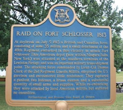
Raid on Fort Schlosser 1813
Erected by Archaeological and Historic Sites Board of Ontario.
Topics. This historical marker is listed in this topic list: War of 1812. A significant historical month for this entry is July 1813.
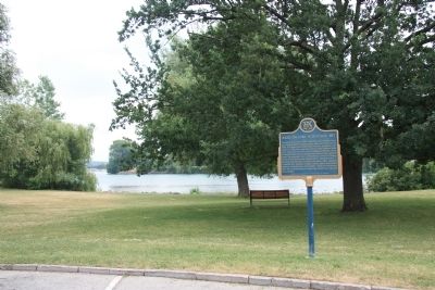
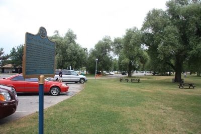
Location. 43° 3.777′ N, 79° 3.023′ W. Marker is near Chippawa, Ontario, in Niagara Region. Marker is at the intersection of Niagara Parkway and Macklem Street, on the right when traveling north on Niagara Parkway. This historical marker is located on the Canadian side of the Niagara River, in a community park on the northern side of the mouth of the Welland River. The historical marker is situated near the front parking lot for King's Bridge Park. Touch for map. Marker is in this post office area: Chippawa ON L2G 6C7, Canada. Touch for directions.
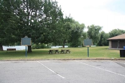
Other nearby markers. At least 8 other markers are within 3 kilometers of this marker, measured as the crow flies. Fort Chippawa 1791 (here, next to this marker); The Founding of Chippawa (approx. 0.4 kilometers away); Church of the Holy Trinity (approx. 0.6 kilometers away); Bridgewater Mills (approx. 1.5 kilometers away); Old Stone Chimney (approx. 1.8 kilometers away in the U.S.); The Niagara River Portage and the Old Stone Chimney (approx. 1.8 kilometers away in the U.S.); Niagara River Overlook (approx. 1.9 kilometers away in the U.S.); Stranded Scow (approx. 2 kilometers away). Touch for a list and map of all markers in Chippawa.
Also see . . .
1. Fort Schlosser. This is a link to information provided by Wikipedia, the free encyclopedia. (Submitted on November 10, 2011, by Dale K. Benington of Toledo, Ohio.)
2. Fort Schlosser. This is a link to information provided by the New York State Military Museum. (Submitted on November 10, 2011, by Dale K. Benington of Toledo, Ohio.)

Photographed By Dale K. Benington, July 28, 2011
2. Raid on Fort Schlosser 1813 Marker
View of featured historical marker on the left and of the adjacent historical marker, "Fort Chippawa 1791," situated between the edge of the parking lot and the north bank of the Welland River, with a view of the public facilities to the right of the picture.
Credits. This page was last revised on September 27, 2019. It was originally submitted on November 5, 2011, by Dale K. Benington of Toledo, Ohio. This page has been viewed 761 times since then and 17 times this year. Photos: 1, 2, 3, 4. submitted on November 10, 2011, by Dale K. Benington of Toledo, Ohio. • Bill Pfingsten was the editor who published this page.


