Saltsburg in Indiana County, Pennsylvania — The American Northeast (Mid-Atlantic)
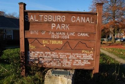
Saltsburg Canal Park
Site of Pennsylvania main line canal 1829-1864
In Saltsburg were two boatyards, warehouses, lift lock number 8 and A turning basin. Salt was shipped from wells nearby. Passengers traveled on packet boats. One of these was owned and operated by J.M. Marshall of Saltsburg.
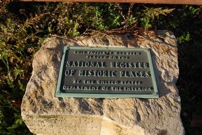
This site is listed on the Pennsylvania inventory of historic places. This property has been placed on the National Register of Historic Places by the United States Department of the Interior
Erected by United States Department of the Interior.
Topics. This historical marker is listed in this topic list: Waterways & Vessels.
Location. 40° 29.18′ N, 79° 27.112′ W. Marker is in Saltsburg, Pennsylvania, in Indiana County. Marker is at the intersection of Washington Street (Pennsylvania Route 286) and West Penn Trail, on the right when traveling west on Washington Street. Touch for map. Marker is in this post office area: Saltsburg PA 15681, United States of America. Touch for directions.
Other nearby markers. At least 8 other markers are within 9 miles of this marker, measured as the crow flies. Saltsburg (a few steps from this marker); The Rivers' Edge (about 700 feet away, measured in a direct line); Fort Elder (approx. 5 miles away); Chalmers "Slick" Goodlin (approx. 6.4 miles away); Thomas F. Gallagher (approx. 6.4 miles away); Fairview Park (approx. 7.6 miles away); Bushy Run (approx. 8.1 miles away); New Salem Borough 100th Anniversary (approx. 8.2 miles away). Touch for a list and map of all markers in Saltsburg.
Also see . . . A Profile in Community Redevelopment: Saltsburg’s Canal Park. Pittsburgh-to-Harrisburg Main Line Canal Greenway website entry (Submitted on June 3, 2022, by Larry Gertner of New York, New York.)

Photographed By Mike Wintermantel, November 5, 2011
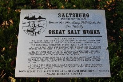
4. Great Salt Works
Saltsburg
Incorporated 1838
Named for the many salt works in the vicinity
Great Salt Works
Salt Industry
The most outstanding early industry in Indiana County was the manufacturing of salt in the Kiskiminetas-Conemaugh Valley.
The commercial production of salt began here in 1813.
By 1816 a major salt boom was underway with 8 wells and 14 furnaces working and produced 100 bushels of salt per day by evaporation.
The salt boom resulted in the founding of a new town called Saltsburg in the fall of 1816 by Andrew Boggs, who was one of the early operators of the salt works in the area.
Saltsburg quickly developed due to the salt industry and to the opening of the Western Division of the Pennsylvania Canal through the town in 1829. Saltsburg was incorporated as a borough on April 16, 1838.
By 1830 there were over 21 salt work within 2 miles of Saltsburg. The average salt works produced one bushel of salt from 80 gallons of water (brine).
Donated by the Saltsburg Area Branch Historical Society Inc., of Indiana County
Credits. This page was last revised on June 4, 2022. It was originally submitted on November 5, 2011, by Mike Wintermantel of Pittsburgh, Pennsylvania. This page has been viewed 1,241 times since then and 43 times this year. Photos: 1, 2, 3, 4. submitted on November 5, 2011, by Mike Wintermantel of Pittsburgh, Pennsylvania.


