Near Flintstone in Allegany County, Maryland — The American Northeast (Mid-Atlantic)
Martins Mountain
Sunday Drivers and “Tin-Can Tourists"
— The Historic National Road - The Road That Built The Nation —
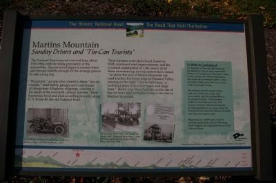
“Waysiders,” people who catered to these “tin-can tourists,” built hotels, garages and road houses all along these Allegheny ridgetops, catering to the needs of the twentieth century traveler. Their businesses lived and died according to traffic along U.S. Route 40, the old National Road.
Their fortunes were short-lived, however. With continued road improvements, and the eventual construction of I-68, nearly all of these mountain top service centers have closed.
“At about the foot of Martin Mountain our road touches the lower edge of Pleasant Valley, passing on the right “Clover Hill Farm,” a well-kept place with a fine house and large barn.” Rocky Gap State Park sits on the site of the old farm, and welcomes today’s traveler to Martins Mountain.
(Sidebar): Six Miles to Cumberland!
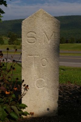
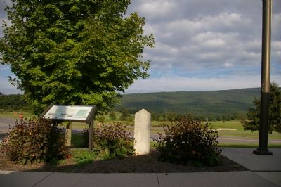
For travelers on the old National Road, the milestone on your right marked the distance to Cumberland, Maryland. Here, as one crossed over Martins Mountain, this stone was a welcome sight to weary travelers as they made their way across some very tough terrain.
The tradition of mile markers dates back over 2,000 years, when they were widely used by roadbuilders of the Roman Empire. This European tradition continued into early 19th century America. Milestones became an important part of a journey along the National Road, when the distance traveled was only a few miles a day.
Beginning in Cumberland, cast-iron obelisks marked the miles to Wheeling, West Virginia, the original terminus of the National Road.
Erected by America's Byways.
Topics and series. This historical marker is listed in these topic lists: Industry & Commerce • Roads & Vehicles. In addition, it is included in the The Historic National Road series list.
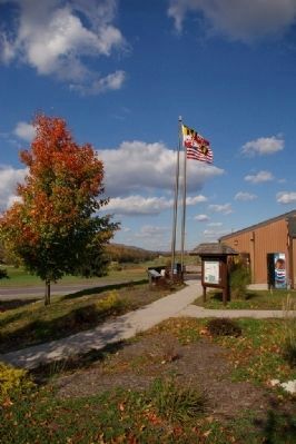
Location. 39° 41.755′ N, 78° 38.976′ W. Marker is near Flintstone, Maryland, in Allegany County. Marker can be reached from Pleasant Valley Road Northeast. This is Wayside 41 on the Historic National Road in Maryland. Touch for map. Marker is at or near this postal address: 12500 Pleasant Valley Road, Northeast, Flintstone MD 21530, United States of America. Touch for directions.
Other nearby markers. At least 8 other markers are within 4 miles of this marker, measured as the crow flies. Life in Pleasant Valley (approx. 0.3 miles away); The Naming of the Lake (approx. ¾ mile away); American Indian Rockshelter Trail (approx. ¾ mile away); Evart's Homesite (approx. 1.3 miles
away); Union Grove School (approx. 2.6 miles away); Washington’s Road (approx. 3½ miles away); Pennsylvania (approx. 3.8 miles away in Pennsylvania); Twiggtown (approx. 3.9 miles away). Touch for a list and map of all markers in Flintstone.
More about this marker. On the lower right is a photo showing "The Wilson and Hartsock families get ready for a family outing on the National Road c. 1920." In the center are two photos of stops on the National Road, captioned, "The rest stop shown above was located on the west side of Martins Mountain. Clover Hill was located close to the entrance of Rocky Gap State Park." The background of the marker is "National Road at Fairview Inn" which is the standard for markers in this series. An elevation diagram of the national road is displayed on the bottom of the marker's face.
Credits. This page was last revised on March 24, 2024. It was originally submitted on January 23, 2008, by Christopher Busta-Peck of Shaker Heights, Ohio. This page has been viewed 2,272 times since then and 128 times this year. Photos: 1. submitted on March 6, 2008, by Christopher Busta-Peck of Shaker Heights, Ohio. 2, 3. submitted on January 23, 2008, by Christopher Busta-Peck of Shaker Heights, Ohio. 4. submitted on March 6, 2008, by Christopher Busta-Peck of Shaker Heights, Ohio. • Craig Swain was the editor who published this page.


