Susan Moore in Blount County, Alabama — The American South (East South Central)
Town of Susan Moore
Photographed by David J Gaines, October 26, 2011
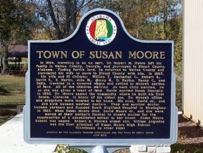
1. Town of Susan Moore Marker
this page online
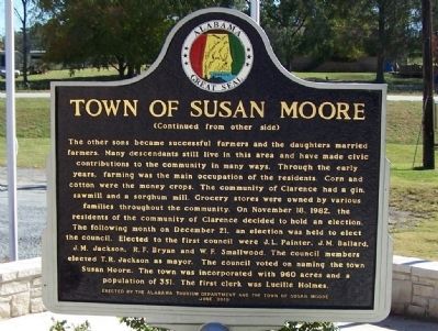
(Back):
The other sons became successful farmers and the daughters married farmers. Many descendants still live in this area and have made civic contributions to the community in many ways. Through the early years, farming was the main occupation of the residents. Corn and cotton were the money crops. The community of Clarence had a gin, sawmill, and a sorghum mill. Grocery stores were owned by various families throughout the community. On November 18, 1982, the residents of the community of Clarence decided to hold an election. The following month on December 21, an election was held to elect the council. Elected to the first council were J. L. Painter, J. M. Ballard, J. M. Jackson, R. F. Bryan, and W. F. Smallwood. The council members elected T. R. Jackson as mayor. The council voted on naming the town Susan Moore. The town was incorporated with 960 acres and a population of 351. The first clerk was Lucille Holmes.
Erected 2010 by Alabama Tourism Department and the Town of Susan Moore. (Marker Number None.)
Topics and series. This historical marker is listed in this topic
Photographed by David J Gaines, October 26, 2011
2. Town of Susan Moore Marker, Side B
Location. 34° 4.905′ N, 86° 25.231′ W. Marker is in Susan Moore, Alabama, in Blount County. It is on Alabama Route 75, on the left when traveling north. Located next to the Susan Moore Town Hall. Touch for map. Marker is in this post office area: Altoona AL 35952, United States of America. Touch for directions.

Regionally, this marker is in North Alabama and in the Birmingham Metropolitan Area. It is also in the American South and specifically in the Deep South. Globally, it is in North America, a Gulf of Mexico state, the Western Hemisphere, the Western World, and the Anglosphere. Historically, it finds itself in what was once the original Cherokee Nation, the territory of the Mississippian Culture, one of the Confederate States of America, and the Antebellum South.
Other nearby markers. At least 8 other markers are within 10 miles of this marker, measured as the crow flies: Bailey School (approx. 2½ miles away); Battle Royal (approx. 4.3 miles away); Exploit of Murphree Sisters
Photographed by David J Gaines, October 26, 2011
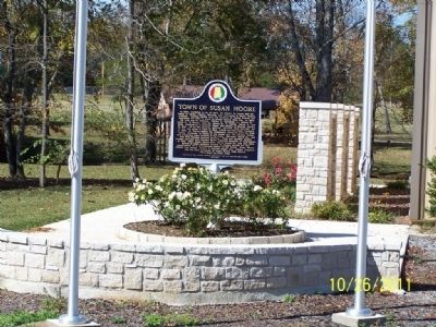
3. Town of Susan Moore Marker
Another marker is no longer nearby. Federal Raid (was approx. 9 miles away but has been permanently removed).
Credits. This page was last revised on June 16, 2016. It was originally submitted on November 6, 2011, by David J Gaines of Pinson, Alabama. This page has been viewed 2,925 times since then and 118 times this year. Photos: 1, 2, 3. submitted on November 6, 2011, by David J Gaines of Pinson, Alabama. • Craig Swain was the editor who published this page.
