Moravia in Lawrence County, Pennsylvania — The American Northeast (Mid-Atlantic)
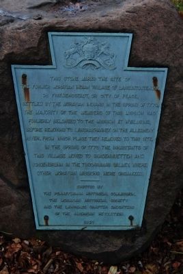
Friedensstadt
Erected 1921 by The Pennsylvania Historical Commission, The Moravian Historical Society and the Lawrence Chapter Daughters of the American Revolution.
Topics and series. This historical marker is listed in these topic lists: Native Americans • Settlements & Settlers. In addition, it is included in the Daughters of the American Revolution series list. A significant historical year for this entry is 1778.
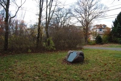
Location. 40° 55.453′ N, 80° 22.795′ W. Marker is in Moravia, Pennsylvania, in Lawrence County. Marker is at the intersection of Donald Road and Pennsylvania Route 18, on the right when traveling north on Donald Road. Donald Road actually splits from PA 18 and rejoins it. The marker is a plaque on a rock between Donald Road and PA 18. Touch for map. Marker is in this post office area: New Castle PA 16102, United States of America. Touch for directions.
Other nearby markers. At least 8 other markers are within 6 miles of this marker, measured as the crow flies. A different marker also named Friedensstadt (within shouting distance of this marker); Wampum Veteran's Memorial (approx. 3 miles away); On August 4, 2000 (approx. 3 miles away); Kuskuskies Towns (approx. 3.2 miles away); Mahoningtown Veterans Memorial (approx. 3.3 miles away); "Squaw Campaign" (approx. 5 miles away); Warner Brothers' First Theater (approx. 5˝ miles away); Lawrence County (approx. 5.9 miles away).
More about this marker. Marker is surrounded by shrubbery and faces PA 18, accessible from Donald Road.
Related markers. Click here for a list of markers that are related to this marker. To better understand the relationship, study each marker in the order shown.
Credits. This page was last revised on September 28, 2017. It was originally submitted on November 11, 2011, by Mike Wintermantel of Pittsburgh, Pennsylvania. This page has been viewed 886 times since then and 56 times this year. Photos: 1, 2. submitted on November 11, 2011, by Mike Wintermantel of Pittsburgh, Pennsylvania.

