Near Philipsburg in Granite County, Montana — The American West (Mountains)
Bi-Metallic Aerial Tramway
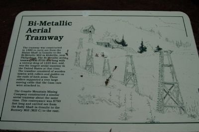
Photographed by Barry Swackhamer, August 9, 2009
1. Bi-Metallic Aerial Tramway Marker
Topics. This historical marker is listed in this topic list: Industry & Commerce. A significant historical year for this entry is 1889.
Location. 46° 18.899′ N, 113° 15.087′ W. Marker is near Philipsburg, Montana, in Granite County. It is on Granite Mountain Road. Granite is located approx. 4 miles from Philipsburg, out the dirt/gravel Granite Mountain Road. Inquire at the Pintler Ranger Station or locally. Follow the signs to Granite. This marker is
this page online

Regionally, this marker is in andspecifically outhwest Montana, in Gold West Country, in Mining Country. It is also in the American Mountain West and in the Lewis & Clark Corridor. Globally, it is in North America, the Rocky Mountains, the Western Hemisphere, the Western World, and the Anglosphere. Historically, it finds itself in what was once Rupert’s Land and also the Louisiana Purchase.
Other nearby markers. At least 8 other markers are within 3 miles of this marker, measured as the crow flies: Miner's Union Hall (approx. 0.2 miles away); Granite Ghost Town (approx. 0.2 miles away); Superintendent’s House (approx. ¼ mile away); Granite Mountain Mining Company Office (approx. 0.3 miles away); Mill A and B (approx. 0.4 miles away); Ruby Shaft (approx. 0.4 miles away); Morse Hall (approx. 2.3 miles away); Weinstein Building (approx. 2.3 miles away). Touch for a list and map of all markers in Philipsburg.
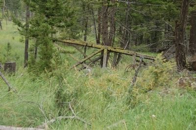
Photographed by Barry Swackhamer, August 9, 2009
2. A Fallen Bi-Metallic Aerial Tramway Tower
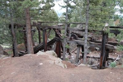
Photographed by Barry Swackhamer, August 9, 2009
3. Rollers for the Aerial Tramway Line
Credits. This page was last revised on June 16, 2016. It was originally submitted on November 15, 2011, by Barry Swackhamer of Brentwood, California. This page has been viewed 1,148 times since then and 26 times this year. Photos: 1, 2, 3. submitted on November 15, 2011, by Barry Swackhamer of Brentwood, California. • Bill Pfingsten was the editor who published this page.
