Big Delta in Southeast Fairbanks Census Area, Alaska — Northwest (North America)
Gold Rush Crossroads
Photographed by Barry Swackhamer, August 1, 2010
1. Gold Rush Crossroads Marker
[Photo captions; counter-clockwise from the top left]
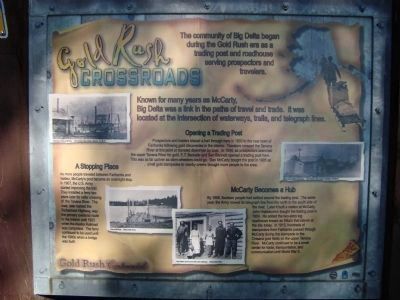
Steamboat docked at McCarty, UAF Archives, Rita Cottnair Collection 74-130-75; Ferry at McCarty, Alaska State Parks; Rika Wadlen (second from left) at the roadhouse, Alaska State Parks; Signal Corps Station at McCarty, UAF Archives, Rita Cottnair Collection 74-130-75.
Steamboat docked at McCarty, UAF Archives, Rita Cottnair Collection 74-130-75; Ferry at McCarty, Alaska State Parks; Rika Wadlen (second from left) at the roadhouse, Alaska State Parks; Signal Corps Station at McCarty, UAF Archives, Rita Cottnair Collection 74-130-75.
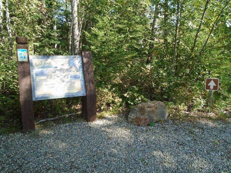
The community of Big Delta began during the Gold Rush era as a trading post and roadhouse serving prospectors and travelers.
Known for many years as McCarty, Big Delta was a link in the paths of travel and trade. It was located at the intersection of waterways, trails and telegraph lines.
this page online
Erected by Alaska Gold Rush Centennial.
Topics. This historical marker is listed in these topic lists: Industry & Commerce • Settlements & Settlers. A significant historical year for this entry is 1903.
Location. 64° 9.286′ N, 145° 50.527′ W. Marker is in Big Delta in Southeast Fairbanks Census Area, Alaska. It can be reached from Richardson Highway. Marker is on the Big Delta State Historical
Photographed by William Fischer, Jr., August 16, 2024
2. Gold Rush Crossroads Marker

Regionally, this marker is in the Athabascan Region and in Interior Alaska. It is also on the American Pacific Coast. Globally, it is in North America, on the Pacific Rim, in the Western Hemisphere, in the Western World, and in the Anglosphere. Historically, it finds itself in what was once the Russian Empire.
Other nearby markers. At least 8 other markers are within walking distance of this marker: Big Delta State Historical Park (a few steps from this marker); Domesticating the Wilderness (within shouting distance of this marker); Barn (within shouting distance of this marker); Homestead Outbuilding (within shouting distance of this marker); Spring House (within shouting distance of this marker); A Place to Rest (within shouting distance of this marker); 30 Ft. Wooden River Boat (within shouting distance of this marker); Roadhouse (within shouting distance of this marker). Touch for a list and map of all markers in
Photographed by William Fischer, Jr., August 16, 2024
3. View from Gold Rush Crossroads Marker
Photographed by William Fischer, Jr., August 16, 2024
4. Rika's Roadhouse
Credits. This page was last revised on January 2, 2025. It was originally submitted on November 17, 2011, by Barry Swackhamer of Brentwood, California. This page has been viewed 864 times since then and 42 times this year. Photos: 1. submitted on November 17, 2011, by Barry Swackhamer of Brentwood, California. 2, 3, 4. submitted on September 2, 2024, by William Fischer, Jr. of Reynoldsburg, Ohio. • Syd Whittle was the editor who published this page.
