Yountville in Napa County, California — The American West (Pacific Coastal)
Yountville's First Fire House
Photographed by Andrew Ruppenstein, April 9, 2011
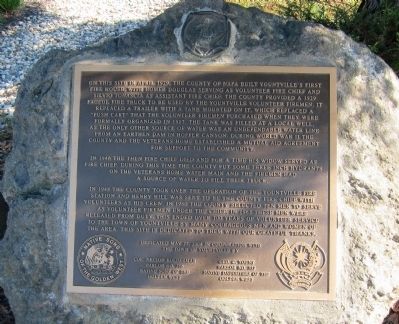
1. Yountville's First Fire House Marker
In 1946, the then fire chief died and for a time his widow served as fire chief. During this time the County put some three inch hyrdants on the Veterans Home water main and the firemen had a source of water to fill their truck.
In 1948 the County took over the operation of the Yountville Fire Station and Henry Hill was sent to be the County Fire Chief with volunteers as his crew. In 1960 the County selected ten men to serve as volunteer firemen under
this page online
The Town of Yountville by
Colonel Nelson Holderman Parlor No. 319
Native Sons of the Golden West
Geo. C. Yount Parlor No. 322
Native Daughters of the Golden West
Erected 2004 by Native Sons of the Golden West Parlor No. 319 and Native Daughters of the Golden West Parlor No. 322.
Topics and series. This historical marker is listed in this topic list: Notable Buildings. In addition, it is included in the Native Sons/Daughters of the Golden West series list. A significant historical month for this entry is April 1929.
Location. 38° 24.225′ N, 122° 21.838′ W. Marker is in Yountville, California, in Napa County. It is at the intersection of Washington Street and Webber Avenue, on the left when traveling south on Washington Street. Touch for map. Marker is in this post office area: Yountville CA 94599, United States of America. Touch for directions.

Regionally,
Photographed by Andrew Ruppenstein, April 9, 2011
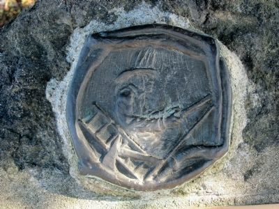
2. Relief of fireman above the marker
Mounted on the rock directly above the marker is a depiction of a fireman with axe, ladder, and fire hose.
Other nearby markers. At least 8 other markers are within walking distance of this marker: Yountville (about 700 feet away, measured in a direct line); Flags over California in 1870 (approx. 0.2 miles away); Groezinger Winery (approx. 0.2 miles away); Yountville Community Hall (approx. ¼ mile away); Map of Groezinger's Addition (approx. ¼ mile away); George Yount's Millstones (approx. ¼ mile away); The Pioneer Christian Church Bell (approx. 0.3 miles away); Grave of George C. Yount (approx. 0.4 miles away). Touch for a list and map of all markers in Yountville.
Photographed by Andrew Ruppenstein, April 9, 2011
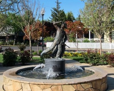
3. Statue of volunteer fireman rushing to fire
In the center of Van de Leur Park, about 50 feet or so from the marker, stands a fountain with a statue of a volunteer fireman, axe and jacket in hand, rushing to a fire.
Photographed by Andrew Ruppenstein, April 9, 2011
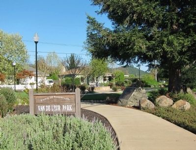
4. Yountville's First Fire House Marker - wide view looking southeast
The marker is mounted to a low rock, visible here just to the right of the pathway, at the northwestern corner of Van De Leur Park.
Credits. This page was last revised on June 16, 2016. It was originally submitted on November 17, 2011, by Andrew Ruppenstein of Lamorinda, California. This page has been viewed 947 times since then and 35 times this year. Photos: 1, 2, 3. submitted on November 17, 2011, by Andrew Ruppenstein of Lamorinda, California. 4. submitted on November 18, 2011, by Andrew Ruppenstein of Lamorinda, California. • Syd Whittle was the editor who published this page.
