
Near Huntsville in Walker County, Texas — The American South (West South Central)
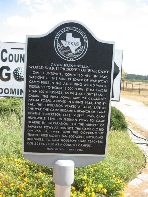
Camp Huntsville
World War II Prisoner of War Camp
Photographed by Steve Gustafson, September 18, 2011
1. Camp Huntsville Marker
Texas in World War II-2006
Erected 2006 by Texas Historical Commission. (Marker Number 13707.)
Topics. This historical marker is listed in this topic list: War, World II. A significant historical month for this entry is January 1948.
Location. 30° 49.217′ N, 95° 25.961′ W. Marker is near Huntsville, Texas, in Walker County. It is at the intersection of State Highway 19 and Knox Circle, on the right when traveling north on State
this page online

Regionally, this marker is in the American South and on the Gulf Coast. Globally, it is in North America, a Gulf of Mexico state, the Western Hemisphere, the Western World, and the Anglosphere. Historically, it finds itself in what was once New Spain, the Republic of Texas, one of the Confederate States of America, and the Antebellum South.
Other nearby markers. At least 8 other markers are within 10 miles of this marker, measured as the crow flies: Akin Hill (approx. 1.9 miles away); Trinity Chapel A.M.E. Church (approx. 8.7 miles away); Black Veteran's Memorial Park (approx. 8.8 miles away); Emancipation Park (approx. 9 miles away); Ranald McDonald House (approx. 9 miles away); Harmon Luther Lowman (approx. 9.1 miles away); Cedar Grove Cemetery (approx. 9.1 miles away); Old Red Schoolhouse (approx. 9.1 miles away). Touch for a list and map of all markers in Huntsville.
Also see . . . The Four Freedoms: Teaching Democracy at Huntsville's Prisoner of War Camp. Sam Houston State
Photographed by Steve Gustafson, September 18, 2011
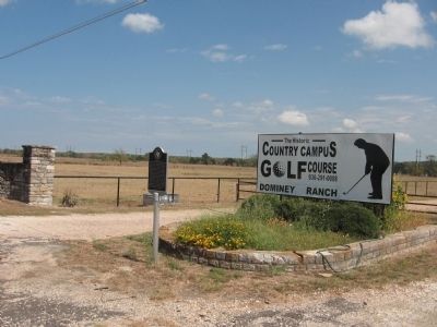
2. Camp Huntsville Marker
Credits. This page was last revised on October 12, 2021. It was originally submitted on November 21, 2011, by Steve Gustafson of Lufkin, Texas. This page has been viewed 3,260 times since then and 421 times this year. Photos: 1, 2. submitted on November 21, 2011, by Steve Gustafson of Lufkin, Texas. • Bernard Fisher was the editor who published this page.
