Near Twain Harte in Tuolumne County, California — The American West (Pacific Coastal)
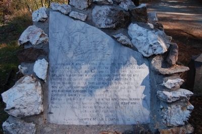
Confidence Mine
Photographed by Barry Swackhamer, October 21, 2011
1. Confidence Mine Marker
Erected 1989 by E Clampus Vitus, Matuca Chapter No. 1849.
Topics and series. This historical marker is listed in these topic lists: Industry & Commerce • Natural Resources. In addition, it is included in the E Clampus Vitus series list. A significant historical year for this entry is 1853.
Location. 38° 2.719′ N, 120° 12.448′ W. Marker is near Twain Harte, California, in Tuolumne County. It is at the intersection
this page online

Regionally, this marker is in California’s Sierra Nevada. It is also in the American Mountain West. Globally, it is in North America, on the Ring of Fire, on the Pacific Rim, in the Western Hemisphere, in the Western World, and in the Anglosphere. Historically, it finds itself in what was once New Spain and also Mexico’s Alta California.
Other nearby markers. At least 8 other markers are within 6 miles of this marker, measured as the crow flies: Sonora Pass – Mono Road (approx. 1.2 miles away); Bald Rock Ranch (approx. 1.3 miles away); Sonora Mono Road (approx. 1.6 miles away); Chief William Fuller (approx. 1.8 miles away); Cherokee (approx. 5 miles away); Soulsbyville (approx. 5.2 miles away); a different marker also named Soulsbyville (approx. 5.2 miles away); The Joseph Lord House (approx. 5.4 miles away). Touch for a list and map of all markers in
Photographed by Barry Swackhamer, October 21, 2011
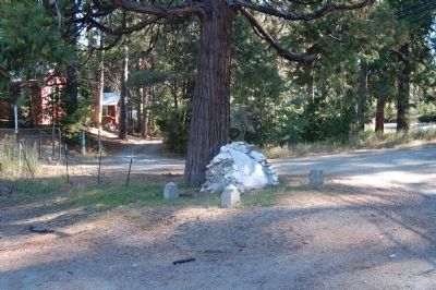
2. Confidence Mine Marker
Credits. This page was last revised on June 16, 2016. It was originally submitted on November 27, 2011, by Barry Swackhamer of Brentwood, California. This page has been viewed 2,266 times since then and 185 times this year. Photos: 1, 2. submitted on November 27, 2011, by Barry Swackhamer of Brentwood, California. • Syd Whittle was the editor who published this page.
