Near Buena Vista in Amherst County, Virginia — The American South (Mid-Atlantic)
Amherst County
⎯⎯⎯
Rockbridge County
Photographed by J. J. Prats, September 18, 2011
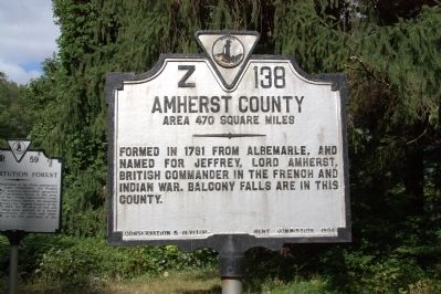
1. Amherst County Face of Marker
Amherst County. Area 470 Square Miles. Formed in 1781 from Albemarle, and named for Jeffrey, Lord Amherst, British commander in the French and Indian War. Balcony Falls are in this county.
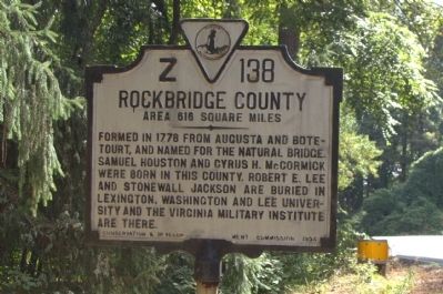
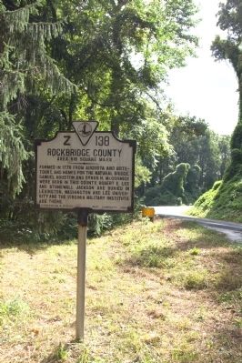
Rockbridge County. Area 616 Square Miles. Formed in 1778 from Augusta and Botetourt, and named for the Natural Bridge. Samuel Houston and Cyrus H. McCormick were born in this county. Robert E. Lee and Stonewall Jackson are buried in Lexington. Washington and Lee University are the Virginia Military Institute are there.
Erected 1934 by Conservation & Development Commission. (Marker Number Z-138.)
Topics and series. This historical marker is listed in this topic list: Political Subdivisions. In addition, it is included in the Virginia Department of Historic Resources (DHR) series list. A significant historical year for this entry is 1781.
Location. 37° 44.543′ N, 79° 18.023′ W. Marker is near Buena Vista, Virginia, in Amherst County. It is at the intersection of Lexington Turnpike / Midland Trail (U.S. 60) and Blue Ridge Parkway and Panther Falls Road, on the right when traveling east on Lexington Turnpike / Midland Trail. Touch for map.
this page online

Regionally, this marker is in Central Virginia. It is also in the American South and specifically in the Upper South. Globally, it is in North America, the Western Hemisphere, the Western World, and the Anglosphere. Historically, it finds itself in what was once the territory of the Mississippian Culture, one of the original Thirteen Colonies, one of the Confederate States of America, and the Antebellum South.
Other nearby markers. At least 8 other markers are within 8 miles of this marker, measured as the crow flies: Constitution Forest (a few steps from this marker); Southern Virginia University (approx. 2.8 miles away); Old Court House (approx. 3 miles away); Veterans Memorial (approx. 3.1 miles away); Charlie Manuel (approx. 3.3 miles away); Moomaw’s Landing (approx. 3.3 miles away); Stonewall Jackson House (approx. 7 miles away); Church Hill (approx. 7.6 miles away). Touch for a list and map of all markers in Buena Vista.
Photographed by J. J. Prats, September 18, 2011
2. Rockbridge County Face of Marker
Photographed by J. J. Prats, September 18, 2011
3. Rockbridge County Face of Marker
Photographed by J. J. Prats, September 18, 2011
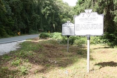
4. Amherst County / Rockbridge County Marker with Constitution Forest Marker
Credits. This page was last revised on February 25, 2023. It was originally submitted on November 27, 2011, by J. J. Prats of Powell, Ohio. This page has been viewed 812 times since then and 25 times this year. Photos: 1, 2, 3, 4. submitted on November 27, 2011, by J. J. Prats of Powell, Ohio.
