Sandy Hook in Washington County, Maryland — The American Northeast (Mid-Atlantic)
Civil War Campgrounds
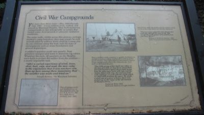
For more than three years - May 1862 through July 1865 - Union soldiers lived, worked, and played on Maryland Heights. They built numerous campgrounds on this inhospitable mountain that lacked water, level ground, or adequate sanitation conditions.
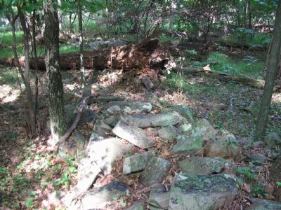
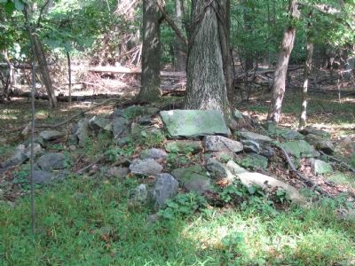
The stone walls, visible across this plateau, perhaps marked a camp boundary; they may simply be rock mounds piled by soldiers while clearing a camp site. As you continue along the trail, look for clues of encampments such as stone foundations and ground depressions.
A soldier's quarters could vary greatly, from primitive canopies and tents to elaborate log cabins. Whatever the style, all quarters on the Heights were built to protect the soldier from the weather - a nearly impossible task.
"After a varied experience of wind, snow, sleet, hail, rain, and mud, the men came to the conclusion that it was nowhere else than up here among these mountains that the weather was made and tried on."
-Joseph Kirkley, 7th Maryland Infantry
Heavy artillery units assigned to specific fortifications resided in huts or cabins weathered to withstand the harsh winters. This 1864 charcoal drawing of a Signal Corps campground reflects the elaborate quarters built on Maryland Heights.
"Our little group of five built our cabin on a bow of a hill, we dug down about three feet and leveled a space about eight by ten feet, the sides were built with logs and the chinks filled with clay; the roof was laid with saplings covered with the earth which we dug while leveling the space. We made a stove out of a piece of heavy sheet iron picked up in the ruins of the old arsenal at Harpers Ferry..."
-Frederick Wild, 1862
Baltimore Battery of Light Artillery
Sibley tents, often adjusted to suit the soldiers' needs, served as basic shelter for infantry regiments.
"The boys have raised the tent about 2 feet with logs and put the tent on top. The cracks they will plaster shut and then we can keep warm."
-William J. Reichard, October 1862
128th Pennsylvania Volunteer Infantry
Topics. This historical marker is listed in this topic list: War, US Civil. A significant historical month for this entry is May 1862.
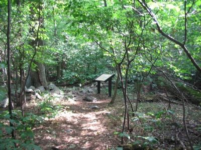
Location. 39° 20.275′ N, 77° 43.315′ W. Marker is in Sandy Hook, Maryland, in Washington County. Marker can be reached from Sandy Hook Road. Located on the Stone Fort Trail loop of Maryland Heights in Harpers Ferry National Historical Park. Touch for map. Marker is in this post office area: Knoxville MD 21758, United States of America. Touch for directions.
Other nearby markers. At least 8 other markers are within walking distance of this marker. 100 - Pounder Battery - Heaviest and Highest (approx. ¼ mile away); Charcoal Making on Maryland Heights (approx. ¼ mile away); Exterior Fort (approx.
¼ mile away); Interior Fort (approx. 0.3 miles away); Making a Mountain Citadel (approx. 0.3 miles away); Stone Fort (approx. 0.4 miles away); 30-Pounder Battery (approx. half a mile away); Hiking Maryland Heights (approx. half a mile away). Touch for a list and map of all markers in Sandy Hook.
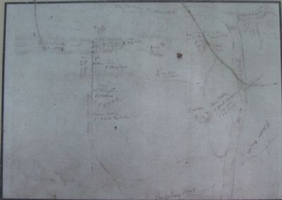
More about this marker. On the lower left of the marker is a "Plan of campgrounds and fortifications on Maryland Heights, by Col. P.A. Porter, 8th New York Heavy Artillery, July 1863." On the right is a photograph of an infantry camp using a Sibley Tent and a charcoal drawing of a heavy artillery camp.
Regarding Civil War Campgrounds. This marker is one of a set along the National Park Service's trail to the top of Maryland Heights.
Credits. This page was last revised on March 19, 2022. It was originally submitted on January 27, 2008, by Craig Swain of Leesburg, Virginia. This page has been viewed 1,784 times since then and 47 times this year. Photos: 1, 2, 3, 4, 5. submitted on January 27, 2008, by Craig Swain of Leesburg, Virginia.
