Carson Park in Long Beach in Los Angeles County, California — The American West (Pacific Coastal)
Ranchos Los Alamitos - Los Cerritos - Los Coyotes
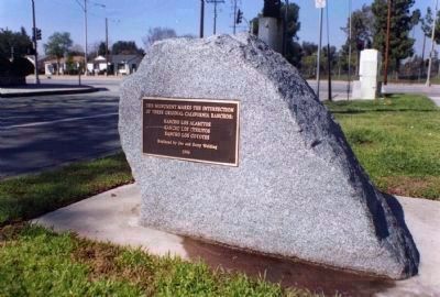
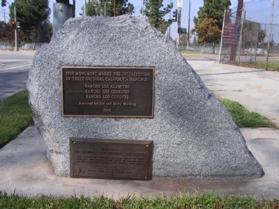
[Upper Marker - as seen in 2001]
This monument marks the intersection of three original California Ranchos:
Rancho Los Cerritos
Rancho Los Coyotes
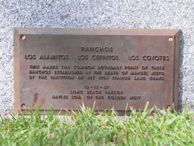
[Lower Marker - as seen in 2002]
Los Alamitos - Los Cerritos - Los Coyotes
[Editors Note: It is assumed that the lower marker was originally placed in 1957. It was replaced by the upper marker in 1996 and then sometime in 2001 or 2002 the original marker was returned and mounted below. It has now been reported to have gone missing.
Erected 1957 by Upper Marker: Joe and Betty Welding. Lower Marker: Long Beach Parlor, Native Sons of the Golden West.
Topics and series. This historical marker is listed in these topic lists: Hispanic Americans • Settlements & Settlers. In addition, it is included in the Native Sons/Daughters of the Golden West series list. A significant historical year for this entry is 1784.
Location. 33° 49.816′ N, 118° 5.95′ W. Marker is in Long Beach, California, in Los Angeles County. It is in Carson Park. Marker is on East Parkcrest Street, on the right when traveling west. Touch for map. Marker is at or near this postal address: 7025 East Parkcrest Street, Long Beach CA 90808, United States of America. Touch for directions.
Other nearby markers. At least 8 other markers are within 3 miles of this marker, measured as the crow flies. This Big Saw (approx. 2.3 miles away); Los Alamitos Sugar Company and Town's Founding (approx. 2.3 miles away); Veterans Memorial (approx. 2˝ miles away); Douglas Park (approx. 2˝ miles away); St. Isidore Historical Plaza (approx. 2˝ miles away); James R. Phillips Plaza (approx. 2˝ miles away); William T. Gross Plaza (approx. 2.6 miles away); Kenneth G. Farrar (approx. 2.6 miles away). Touch for a list and map of all markers in Long Beach.
Credits. This page was last revised on January 30, 2023. It was originally submitted on November 30, 2011, by Michael Kindig of Elk Grove, California. This page has been viewed 1,329 times since then and 58 times this year. Last updated on December 6, 2011, by Michael Kindig of Elk Grove, California. Photos: 1, 2, 3. submitted on November 30, 2011, by Michael Kindig of Elk Grove, California. • Syd Whittle was the editor who published this page.


