Shingle Springs in El Dorado County, California — The American West (Pacific Coastal)
Du Roc House
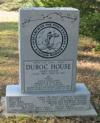
In Search of the Pony Express
— Historical Marker —
Du Roc House
Added Station
July 1, 1861 – Nov. 20, 1861
by
PW Pipe
James Stretesky
Norman & Ann Root
County of El Dorado
American Suzuki Motor Corporation
Pony Express Trail Association
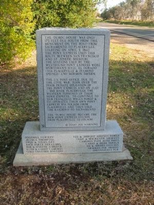
[Rear Side of Marker:]
The “Du Roc House” was only 175 feet due south from this monument on the road from Sacramento to Placerville. Starting on April 3, 1860 the Pony Express used this route between San Francisco and St. Louis, Missouri. The stations used by the westbound Pony Express were Sportsman Hall, El Dorado (via Placerville & Diamond Springs) and Mormon Tavern.
The U.S. Post Office, due to the Civil War, took over the prior private operation of the Pony Express and on July 1, 1861 made Placerville the Western Terminus of their Pony Express. To continue to San Francisco, Wells Fargo & Co. operated their own Pony Express via Folsom from Placerville and then used the railroad to Sacramento.
The “Du Roc House” became the new Pony Express Station from Placerville to Folsom.
©2000 Joe Nardone
Additional sponsors are listed at the bottom of the base.
Erected 2002 by PW Pipe, James Stretesky, Norman & Ann Root, County of El Dorado, American Suzuki Motor Corporation, Pony Express Trail Association.
Topics and series. This historical marker is listed in this topic list: Communications. In addition, it is included in the Pony Express National Historic Trail series list. A significant historical month for this entry is April 1862.
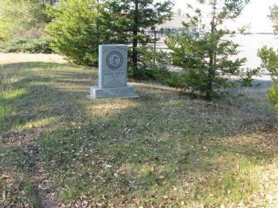
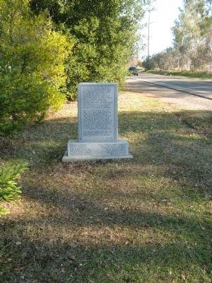
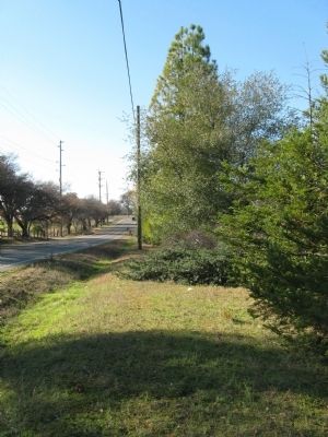
Location. 38° 39.19′ N, 120° 57.8′ W. Marker is in Shingle Springs, California, in El Dorado County. Marker is on Durock Road south of U.S. 50, on the right when traveling west. Take the Cameron Park Drive Exit. Cameron Park becomes Durock Road two blocks south of US 50. Touch for map. Marker is at or near this postal address: 3441 Durcock Road, Shingle Springs CA 95682, United States of America. Touch for directions.
Other nearby markers. At least 8 other markers are within 7 miles of this marker, measured as the crow flies. Camp Site of Boston-Newton Party (approx. 2.1 miles away); James Skinner Winery & Distillery (approx. 3.6 miles away); The Coloma Road (approx. 4.1 miles away); Old Coloma Road (approx. 4.1 miles away); Pleasant Grove House (approx. 4.4 miles away); Mormon Tavern (approx. 5.2 miles away); El Dorado (Mud Springs) (approx. 6˝ miles away); El Dorado (approx. 6˝ miles away).
Regarding Du Roc House. Prior to the Pony Express Route passing through this area, there had already been a post office near this site. In his 2002 publication Post Offices of El Dorado County Doug Noble writes:
"This post office was originally known as El Dorado Ranch. El Dorado Ranch post office was located half way between Mud Springs (El Dorado) and Clarksville, being eight miles from each on the main east-west immigrant road, according to the application filed in Washington, D.C., although the exact location is unknown (a "ghost" post office). The proposed name for the post office established at this location on June 19, 1857 was Deer Creek, although El Dorado Ranch ended up being the actual name. Lyman A. Hoyt was the first postmaster and on Sept. 14, 1858 the name of the post office was changed to DuRoc.
The first postmaster at the DuRoc (later Duroc and even later Durock) Post Office was Theron Foster. The name most likely comes from the name of a French family who owned the Du Roc House, a stop on this famous immigrant trail. On Nov. 23, 1864, about the same the time the railroad reached Shingle Springs and the traffic on the road decreased substantially, the post office closed. A portion of the old highway from Shingle Springs to Cameron Park still has the name Durock.".
Credits. This page was last revised on June 16, 2016. It was originally submitted on December 9, 2011, by Syd Whittle of Mesa, Arizona. This page has been viewed 1,090 times since then and 35 times this year. Photos: 1, 2, 3, 4, 5. submitted on December 9, 2011, by Syd Whittle of Mesa, Arizona.
