Norwell in Plymouth County, Massachusetts — The American Northeast (New England)
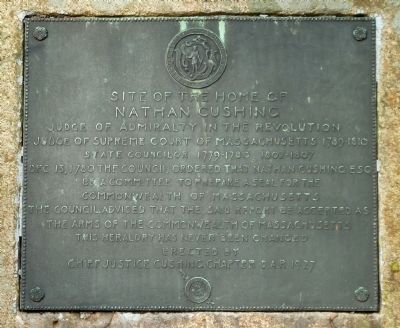
Nathan Cushing
Nathan Cushing
Judge of Admiralty in the Revolution
Judge of Supreme Court of Massachusetts 1789–1810
State Councilor 1779–1780 1802–1807
Dec 13, 1780 the council ordered that Nathan Cushing Esq
be a committee to prepare a seal for the
Commonwealth of Massachusetts
The council advised that the said report be accepted as
the arms of the Commonwealth of Massachusetts
This heraldry has never been changed
Erected 1927 by the Chief Justice Cushing Chapter D.A.R.
Topics and series. This historical marker is listed in these topic lists: Government & Politics • War, US Revolutionary. In addition, it is included in the Daughters of the American Revolution series list. A significant historical month for this entry is December 1897.
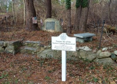
Location. 42° 9.74′ N, 70° 48.401′ W. Marker is in Norwell, Massachusetts, in Plymouth County. Marker is on Main Street (Massachusetts Route 123), on the right when traveling west. Marker is about 100 yards past the intersection with Lincoln Street. Touch for map. Marker is in this post office area: Norwell MA 02061, United States of America. Touch for directions.
Other nearby markers. At least 8 other markers are within 4 miles of this marker, measured as the crow flies. The “Columbia” (approx. 0.7 miles away); The Old Oaken Bucket (approx. 2.8 miles away); Old Stockbridge Grist Mill (approx. 3.1 miles away); Site of Stockbridge Mansion (approx. 3.1 miles away); Cudworth House (approx. 3.7 miles away); On North River (approx. 3.7 miles away); Lawson Tower (approx. 3.7 miles away); North River Bridge (approx. 3.7 miles away).
Also see . . .
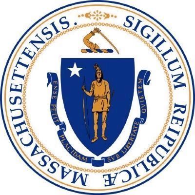
1. The Great Seal of Massachusetts. (Submitted on December 10, 2011, by Roger W. Sinnott of Chelmsford, Massachusetts.)
2. Massachusetts State Seal - Wikipedia. This link contains the original seal designed by Nathan Cushing. (Submitted on December 12, 2011, by Bill Pfingsten of Bel Air, Maryland.)
Credits. This page was last revised on June 16, 2016. It was originally submitted on December 10, 2011, by Roger W. Sinnott of Chelmsford, Massachusetts. This page has been viewed 788 times since then and 50 times this year. Photos: 1, 2, 3. submitted on December 10, 2011, by Roger W. Sinnott of Chelmsford, Massachusetts. • Bill Pfingsten was the editor who published this page.


