Belle in Kanawha County, West Virginia — The American South (Appalachia)
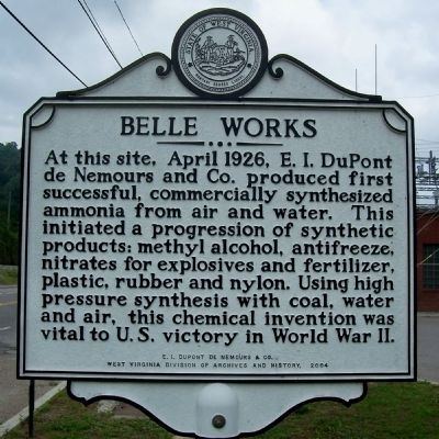
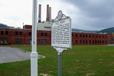
Belle Works
Erected 2004 by E. I. DuPont de Nemours & Co. - West Virginia Division of Archives and History.
Topics and series. This historical marker is listed in these topic lists: Industry & Commerce • War, World II. In addition, it is included in the West Virginia Archives and History series list. A significant historical month for this entry is April 1926.
Location. 38° 14.653′ N, 81° 33.232′ W. Marker is in Belle, West Virginia, in Kanawha County. Marker is on West DuPont Avenue (County Route 60/12), on the right when traveling east. Touch for map. Marker is in this post office area: Belle WV 25015, United States of America. Touch for directions.
Other nearby markers. At least 8 other markers are within walking distance of this marker. World War II Memorial (approx. half a mile away); Veterans Memorial (approx. half a mile away); Captain Larry F. Lucas (approx. half a mile away); Marmet Veteran's Tribute (approx. half a mile away); Corporal Victor Theodore Lake Jr. (approx. half a mile away); Camp Piatt (approx. 0.6 miles away); Methodist Episcopal Church South Bell (approx. 0.7 miles away); Samuel Shrewsbury House (approx. 0.7 miles away). Touch for a list and map of all markers in Belle.
Credits. This page was last revised on August 13, 2019. It was originally submitted on December 13, 2011, by Forest McDermott of Masontown, Pennsylvania. This page has been viewed 623 times since then and 16 times this year. Photos: 1, 2. submitted on December 13, 2011, by Forest McDermott of Masontown, Pennsylvania. 3. submitted on August 13, 2019, by J. J. Prats of Powell, Ohio. • Bill Pfingsten was the editor who published this page.


