Bowman in Orangeburg County, South Carolina — The American South (South Atlantic)
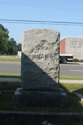
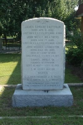
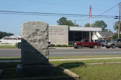
Bowman S.C.
Memorial
Born Apr. 8, 1892
Lost on U.S.S. Cyclops, Mar. 4, 1918.
—–—
John Wesley Weathers
Born Apr. 17, 1895
Lost on U.S.S. Cyclops, Mar. 4, 1918.
—–—
John Moorer Livingston
Born Mar. 28, 1895.
Died Camp Sevier
Greenville, S.C. Nov. 24, 1917
———
Samuel Dibble, Sr.
Founder of Bowman
Sept. 16, 1837 - Sept. 16, 1913
———
S.W. Berry, Mayor
———
Warden
———
C.J. Rickenbaker, J.A. Riley
A.Z. Smith, Sr. S.J. West
———
This Monument Erected By
The Community of Bowman S.C.
Topics. This historical marker is listed in this topic list: Notable Places. A significant historical date for this entry is March 4, 1909.
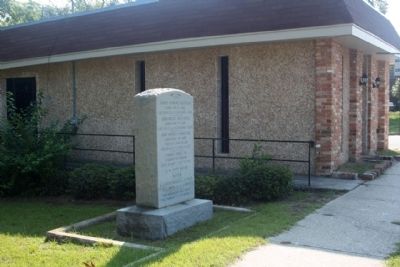
Location. 33° 20.967′ N, 80° 40.991′ W. Marker is in Bowman, South Carolina, in Orangeburg County. Marker is on Charleston Highway (U.S. 178) near Park Street, on the right when traveling north. Touch for map. Marker is in this post office area: Bowman SC 29018, United States of America. Touch for directions.
Other nearby markers. At least 8 other markers are within 9 miles of this marker, measured as the crow flies. Bowman War Memorial (within shouting distance of this marker); Captain Richard A Morris (within shouting distance of this marker); Bowman Rosenwald School (approx. half a mile away); Walnut Grove Church (approx. 5.2 miles away); Shady Grove Camp Ground (approx. 7.1 miles away); Moorefield Memorial Highway (approx. 7.9 miles away); White House Church (approx. 7.9 miles away); Astronaut Frank L. Culbertson, Jr. (approx. 8.1 miles away). Touch for a list and map of all markers in Bowman.
Also see . . .
1. Bowman. Wikipedia entry:
The site chosen for Bowman was actually situated in the center of a rice farming country, later transformed into a major cotton producing area where the land has a clay sub-soil, ideal for this and other crops. it was located on an old road that was traveled in colonial days by people going from Charleston to Orangeburg (Submitted on December 15, 2011, by Mike Stroud of Bluffton, South Carolina.)
2. The Disappearance of the USS Cyclops. Historic Mysteries website entry:
The area that the USS Cyclops disappeared in, is the infamous Bermuda Triangle. The USS Cyclops is only one of many ships that have reportedly gone missing in the area. (Submitted on December 15, 2011, by Mike Stroud of Bluffton, South Carolina.)
Additional commentary.
1. Bowman
is located in Orangeburg County, southeast of the City of Orangeburg on US 178. It is the dairy capital of South Carolina.
Bowman has been a farming community since the town formed in the late 1800s. When the boll weevil decimated the cotton crop in the 1920s, area farmers bought more milk cows and took to dairy farming.
Where cotton once was king, milk now reigns. Each day, around 20 dairy farms in the Bowman area milk between 50-700 cows each and ship up to 14,000 gallons of milk to processing and distribution plants in Orangeburg,
Columbia, Charleston, and Florence. Orangeburg is the largest city near Bowman. (South Carolina's Information Highway)
— Submitted December 15, 2011, by Mike Stroud of Bluffton, South Carolina.
2. Camp Sevier,
Hastily erected in 1917 to help America respond to the Allies' need for freshly trained troops for World War I, the camp was located 6 miles from Greenville and covered 1,900 acres. It included a hospital, drill grounds, bakery and barracks for the Army's 30th Infantry/Field Artillery Division. 80,000 men were trained here for World War I. Following basic training, soldiers were shipped from here to Charleston for combat in France.
— Submitted December 15, 2011, by Mike Stroud of Bluffton, South Carolina.
Credits. This page was last revised on September 10, 2022. It was originally submitted on December 15, 2011, by Mike Stroud of Bluffton, South Carolina. This page has been viewed 796 times since then and 25 times this year. Photos: 1, 2, 3, 4. submitted on December 16, 2011, by Mike Stroud of Bluffton, South Carolina.


