
Near Radford in Pulaski County, Virginia — The American South (Mid-Atlantic)
Montgomery County / Pulaski County
Photographed By J. J. Prats, May 30, 2011
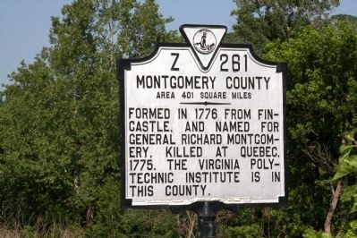
1. Montgomery County Face of Marker
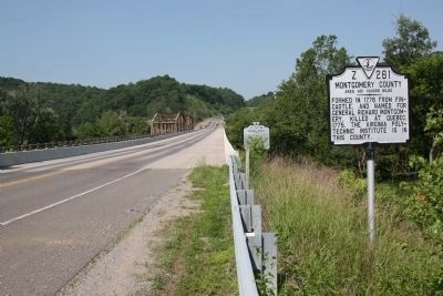
Montgomery County. Area 401 Square Miles. Formed in 1776 from Fincastle, and named for General Richard Montgomery, killed at Quebec, 1775. The Virginia Polytechnic Institute is in this county.
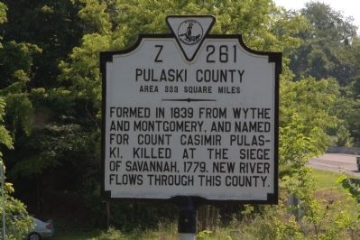
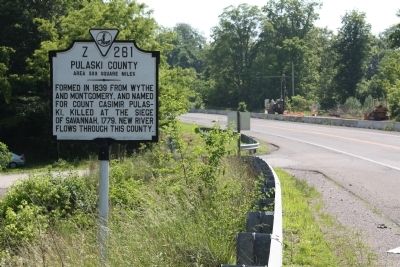
Pulaski County. Area 333 Square Miles. Formed in 1839 from Wythe and Montgomery, and named for Count Casimir Pulaski, killed at the siege of Savanna, 1779. New River flows through this county.
Erected 1946 by Virginia Conservation & Development Commission. (Marker Number Z-261.)
Topics and series. This historical marker is listed in this topic list: Political Subdivisions. In addition, it is included in the Virginia Department of Historic Resources (DHR) series list. A significant historical year for this entry is 1776.
Location. 37° 9.636′ N, 80° 33.227′ W. Marker is near Radford, Virginia, in Pulaski County. Marker is at the intersection of Riverhaven Drive (Virginia Route 114), on the right when traveling east on Riverhaven Drive. Touch for map. Marker is at or near this postal address: 6942 Riverhaven Dr, Radford VA 24141, United States of America. Touch for directions.
Other nearby markers. At least 8 other
this page online
Photographed By J. J. Prats, May 30, 2011
2. Pulaski County face of Marker
Photographed By J. J. Prats, May 30, 2011
3. Pulaski County Face of Marker
Photographed By J. J. Prats, May 30, 2011
4. Montgomery County Face of Marker
The Roads West marker is in the distance.
Credits. This page was last revised on July 8, 2021. It was originally submitted on December 17, 2011, by J. J. Prats of Powell, Ohio. This page has been viewed 411 times since then and 19 times this year. Photos: 1, 2, 3, 4. submitted on December 17, 2011, by J. J. Prats of Powell, Ohio.

