Camp Pendleton South in San Diego County, California — The American West (Pacific Coastal)
El Camino Real Bell
— Marine Corps Base, Camp Pendleton —
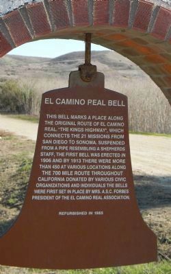
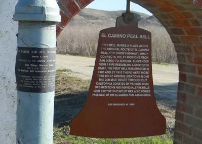
Panel 1:
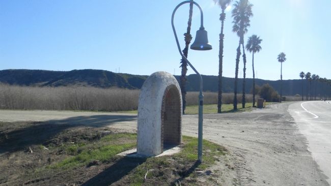
This bell marks a place along the original route of El Camino Real, “The Kings Highway”, which connects the 21 missions from San Diego to Sonoma. Suspended from a pipe resembling a shepherd’s staff, the first bell was erected in 1906, and by 1913 there were more than 450 at various locations along the 700 mile route throughout California. Donated by various civic organizations and individuals, the bells were first set in place by Mrs. A.S.C. Forbes, president of the El Camino Real Association.
Refurbished in 1985.
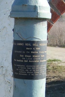
Panel 2:
El Camino Real Bell Rededicated
March 4, 1999
Sponsored by the Marine Corps Base
San Diego Mission Bells
the Local Chapter of the American Bell Association International
The rededication, refurbishing and restoration of the
El Camino Real Bell commemorates
This historic site on the trail used by the
California Mission Padres and the
200th Anniversary of the San Luis Rey Mission
Erected 1985 by El Camino Real Association.
Topics and series. This historical marker is listed in these topic lists: Exploration • Roads & Vehicles. In addition, it is included in the El Camino Real, “The King's Highway” (California) series list. A significant historical month for this entry is March 1873.
Location. 33° 15.379′ N, 117° 22.232′ W. Marker is in Camp Pendleton South, California, in San Diego County. Marker is on Vandegrift Boulevard north of Stewart Mesa/Ash Road. Camp Pendleton is accessible from I-5 via the Harbor Drive exit in Oceanside, California. Visitors without military identification must apply for admission to the Base at the main gate. Touch for map. Marker is in this post office area: Camp Pendleton CA 92055, United States of America. Touch for directions.
Other nearby markers. At least 8 other markers are within 4 miles of this marker, measured as the crow flies. Retreat Hell! (approx. 2.4 miles away); Boys of '45 (approx. 2.4 miles away); Alligator Marines (approx. 3.1 miles away); Walled Garden (approx. 3.2 miles away); Mission San Luís Rey de Francia (approx. 3.4 miles away); AH-1W "Super Cobra" (approx. 3½ miles away); Remember Pearl Harbor (approx. 3.6 miles away); El Camino Real Guidepost Bells (approx. 3.9 miles away). Touch for a list and map of all markers in Camp Pendleton South.
Also see . . .
1. Camp Pendleton. (Submitted on December 19, 2011, by Richard E. Miller of Oxon Hill, Maryland.)
2. California Bell Company. The manufacturers of the El Camino Real Bells. Photos and historical information is detailed. (Submitted on December 29, 2011.)
Credits. This page was last revised on March 26, 2024. It was originally submitted on December 18, 2011, by Richard E. Miller of Oxon Hill, Maryland. This page has been viewed 1,502 times since then and 119 times this year. Photos: 1, 2, 3, 4. submitted on December 18, 2011, by Richard E. Miller of Oxon Hill, Maryland. 5, 6. submitted on May 11, 2012, by Richard E. Miller of Oxon Hill, Maryland. • Syd Whittle was the editor who published this page.
