Near Blythe in Riverside County, California — The American West (Pacific Coastal)
Wiley Well

Photographed by Sonia Eskandarian, December 23, 2025
1. Wiley Well Marker
Erected 1985 by Billy Holcomb Chapter E.C.V. and Erin Port, Palo Verde Historical Society. (Marker Number 11.)
Topics and series. This historical marker is listed in this topic list: Settlements & Settlers. In addition, it is included in the E Clampus Vitus series list.
Location. 33° 36.595′ N, 114° 54.015′ W. Marker is near Blythe, California, in Riverside County. It can be reached from Wiley Well Road 0.1 miles north of Interstate 10. Located in Wiley’s Well Rest Area. Touch for map. Marker is in this post office area: Blythe CA 92225, United States of America. Touch for directions.

Regionally, this marker is in Greater Los Angeles, in the Colorado Desert, and in the Peninsular Ranges. It is also in the American
this page online
Other nearby markers. At least 3 other markers are within 16 miles of this marker, measured as the crow flies: 390th Bomb Group (H) (approx. 10.8 miles away); Camp Gaston (approx. 15.6 miles away); Taylor's Ferry (approx. 15.6 miles away).
Regarding Wiley Well. The well was "out in the middle of nowhere" and a life saver for many. Noted desert writer James Smeaton Chase traversed the Colorado Desert during the years 1916-1918 to gain a better experience with it. Chase was warned when heading west from Blythe that about 60' of roper was needed to reach water at the well and he only had 40'. He obtained the extra rope and all was "well". A Clampout in October 1975 was convened to erect a monument here. Technical difficulties prevented the Plaque from being erected.
SOURCE: Billy Holcomb Chapter 1069 35th Anniversary Plaque Book by Phillip Holdaway
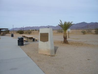
Photographed by Bill Kirchner, December 26, 2010
2. Wiley Well Marker

Photographed by Michael Kindig, March 16, 2013
3. Old Wiley Well

Photographed by Michael Kindig, March 16, 2013
4. Old Wiley Well
“Old Wiley Well dug by hand to 40 ft. - 1907”
Credits. This page was last revised on February 14, 2026. It was originally submitted on January 4, 2011, by Bill Kirchner of Tucson, Arizona. This page has been viewed 1,468 times since then and 55 times this year. Last updated on December 18, 2011, by Michael Kindig of Elk Grove, California. Photos: 1. submitted on December 30, 2025, by Craig Baker of Sylmar, California. 2. submitted on January 4, 2011, by Bill Kirchner of Tucson, Arizona. 3, 4. submitted on March 19, 2013, by Michael Kindig of Elk Grove, California. • Syd Whittle was the editor who published this page.
