
Near Hopwood in Fayette County, Pennsylvania — The American Northeast (Mid-Atlantic)
Braddock Road
Rock Fort Camp
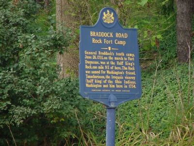
Photographed By J. J. Prats, August 27, 2006
1. Braddock Road - Rock Fort Camp Marker
Erected 1952 by the Pennsylvania Historical and Museum Commission.
Topics and series. This historical marker is listed in this topic list: War of 1812. In addition, it is included in the Braddock’s Road and Maj. Gen. Edward Braddock, and the Pennsylvania Historical and Museum Commission series lists. A significant historical month for this entry is June 1954.
Location. 39° 50.994′ N, 79° 39.448′ W. Marker is near Hopwood, Pennsylvania, in Fayette County. Marker is at the intersection of National Pike (U.S. 40) and Jumonville Road (Pennsylvania Route 2021), on the right when traveling west on National Pike. Touch for map. Marker is in this post office area: Hopwood PA 15445, United States of America. Touch for directions.
Other nearby markers. At least 5 other markers are within 2 miles of this marker, measured as the crow flies. History Flows Through This Land (approx. 0.7 miles away); History Flows Through These Waters (approx. ¾ mile away); Washington–Braddock Road 1754–1756 (approx. one mile away); Washington’s Spring (approx. one
this page online
Also see . . . Tanaghrisson. Page from the Dictionary of Canadian Biography Online. (Submitted on August 31, 2006.)
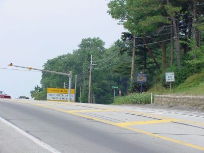
Photographed By J. J. Prats, August 27, 2006
2. Braddock Road - Rock Fort Camp Marker
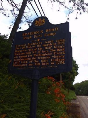
Photographed By William Richard Harrison
3. Braddock Road - Rock Fort Camp Marker
Credits. This page was last revised on July 14, 2019. It was originally submitted on August 31, 2006, by J. J. Prats of Powell, Ohio. This page has been viewed 2,834 times since then and 38 times this year. Photos: 1, 2. submitted on August 31, 2006, by J. J. Prats of Powell, Ohio. 3. submitted on March 1, 2012, by William Richard Harrison of Pittsburgh, Pennsylvania.

