Topeka in Shawnee County, Kansas — The American Midwest (Upper Plains)
Site of the First State Capitol
Photographed by William Fischer, Jr., July 17, 2011
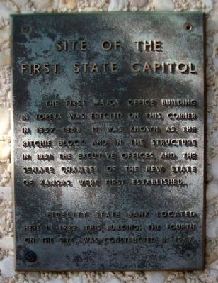
1. Site of the First State Capitol Marker
The first major office building in Topeka was erected on this corner in 1857-1858. It was known as the Ritchie Block and in the structure in 1861 the Executive Offices and the Senate Chamber of the new State of Kansas were first established.
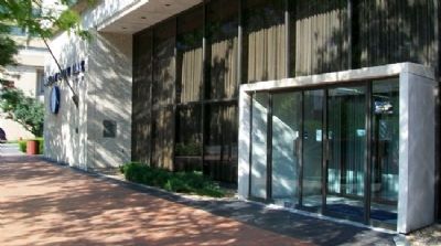
Fidelity State Bank located here in 1922. This building, the fourth on this site, was constructed in 1967.
Erected by Fidelity State Bank.
Topics. This historical marker is listed in this topic list: Government & Politics. A significant historical year for this entry is 1861.
Location. 39° 3.084′ N, 95° 40.391′ W. Marker is in Topeka, Kansas, in Shawnee County. It is at the intersection of SW Kansas Avenue and SE 6th Avenue, on the right when traveling north on SW Kansas Avenue. Touch for map. Marker is at or near this postal address: 600 SW Kansas Avenue, Topeka KS 66603, United States of America. Touch for directions.

Regionally, this marker is in Eastern Kansas. It is also in the American Midwest, in the Corn Belt, on the prairies, and on the Southern Plains. Globally, it is in North America, the Western Hemisphere, the Western World, and the Anglosphere. Historically,
this page online
Other nearby markers. At least 8 other markers are within walking distance of this marker: Constitution Hall -Topeka (approx. 0.2 miles away); Mariachi Divina! (approx. 0.2 miles away); Church of the Assumption (approx. ¼ mile away); Samuel J. Crumbine, MD (approx. ¼ mile away); In the Year of Our Nation's Bicentennial (approx. ¼ mile away); Replica of the Statue of Liberty (approx. 0.3 miles away); St. John AME Church (approx. 0.4 miles away); Alfred M. Landon State Office Building (approx. 0.4 miles away). Touch for a list and map of all markers in Topeka.
Photographed by William Fischer, Jr., July 17, 2011
2. Site of the First State Capitol Marker
Credits. This page was last revised on June 16, 2016. It was originally submitted on December 20, 2011, by William Fischer, Jr. of Reynoldsburg, Ohio. This page has been viewed 537 times since then and 37 times this year. Photos: 1, 2. submitted on December 20, 2011, by William Fischer, Jr. of Reynoldsburg, Ohio.
