Wauwatosa in Milwaukee County, Wisconsin — The American Midwest (Great Lakes)
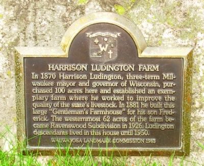
Harrison Ludington Farm
Photographed by Paul Fehrenbach, October 14, 2011
1. Harrison Ludington Farm Marker
Erected 1983 by Wauwatosa Landmark Commission.
Topics. This historical marker is listed in this topic list: Notable Buildings. A significant historical year for this entry is 1870.
Location. 43° 2.103′ N, 88° 0.996′ W. Marker is in Wauwatosa, Wisconsin, in Milwaukee County. It is on North Glenview Avenue (State Highway 181) 0.1 miles south of West Bluemound Road (U.S. 18), on the right when traveling south. Touch for map. Marker is at or near this postal address: 343 Glenview Ave, Milwaukee WI 53213, United States of America. Touch for directions.

Regionally, this marker is in Southeast Wisconsin and in Greater Milwaukee. It is also in the American Midwest and in the Corn Belt. Globally, it is in North America,
this page online
Other nearby markers. At least 8 other markers are within 2 miles of this marker, measured as the crow flies: Milwaukee County Cemetery (approx. one mile away); Harts Mills (approx. one mile away); President Abraham Lincoln (approx. 1.1 miles away); Tee Sisikeja (Bad Waters Village) (approx. 1.1 miles away); Dittmar-Robertson Building (approx. 1.1 miles away); Wisconsin State Fair Park (approx. 1.1 miles away); Camp Harvey (approx. 1.1 miles away); Church Street Historic District (approx. 1.1 miles away). Touch for a list and map of all markers in Wauwatosa.
Photographed by Paul Fehrenbach, October 14, 2011
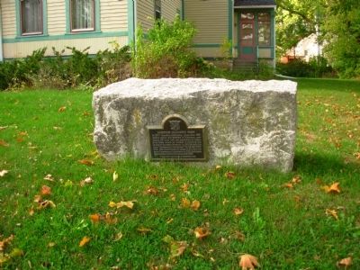
2. Harrison Ludington Farm Marker
Photographed by Paul Fehrenbach, October 14, 2011
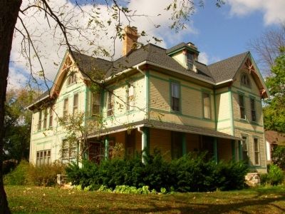
3. Harrison Ludington House
Photographed by Paul Fehrenbach, October 14, 2011
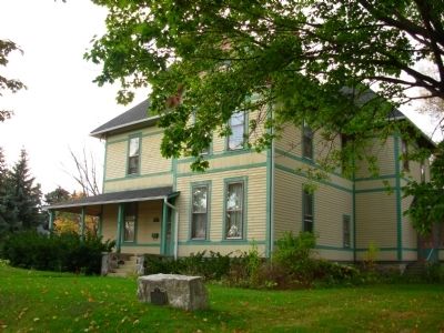
4. Harrison Ludington House
Credits. This page was last revised on February 16, 2023. It was originally submitted on December 22, 2011, by Paul Fehrenbach of Richfield, Wisconsin. This page has been viewed 1,401 times since then and 67 times this year. Photos: 1, 2, 3, 4. submitted on December 22, 2011, by Paul Fehrenbach of Richfield, Wisconsin. • Bernard Fisher was the editor who published this page.
