Charleston in Las Vegas in Clark County, Nevada — The American Mountains (Southwest)
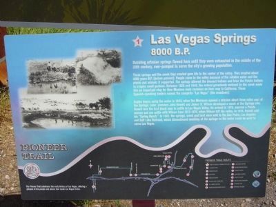
Las Vegas Springs
8000 B.P.
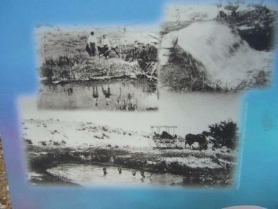
These springs and the creek they created gave life to the center of the valley. They erupted about 8000 years B.P. (before present). People came to the valley because of the reliable water and the plants and animals it supported. The springs allowed the Anasazi Indians and later the Paiute Indians to irrigate small gardens. Between 1829 and 1848, the natural grasslands watered by the creek made this an important stop for New Mexican mule caravans on their way to California. These Spanish-speaking traders named the campsite "Las Vegas" (the meadows).
Anglos began using the water in 1855, when the Mormons opened a mission about three miles east of the Springs. Later, pioneers John Howell and James B. Wilson developed a ranch at the Springs site. Howell was the first black man to settle in Las Vegas Valley. He arrived in 1870, married a Paiute woman and ran cattle with Wilson from 1872-1874, when Wilson left the valley. In 1876, Howell sold his "Spring Ranch." In 1902, the springs, creek and land were sold to the San Pedro, Los Angeles and Salt Lake Railroad, which discontinued ranching at the springs so the water could be used to serve Las Vegas.
Erected by the City of Las Vegas, Clark County, Preserve America & the Southern Nevada Public Lands Management Act. (Marker Number 1.)
Topics. This historical marker is listed in these topic lists: Agriculture • Natural Resources • Settlements & Settlers.
Location. 36° 10.219′ N, 115° 11.544′ W. Marker is in Las Vegas, Nevada, in Clark County. It is in Charleston. Marker is at the intersection of South Valley View Boulevard and Meadows Lane, on the right when traveling north on South Valley View Boulevard. Marker is on the northeast corner. Touch for map. Marker is in this post office area: Las Vegas NV 89152, United States of America. Touch for directions.
Other nearby markers. At least 8 other markers are within 2 miles of this marker, measured as the crow flies. A different marker also named Las Vegas Springs (here, next to this marker); Las Vegas (The Meadows) (approx. 0.2 miles away); Lorenzi Park (approx. 0.7 miles away); First Water Company (approx. ¾ mile away); Old Well Tower #10 (approx. ¾ mile away); Padre Francisco Garcés (approx. ¾ mile away); Twin Lakes Lodge (approx. 0.8 miles away); Binion House (approx. 1.3 miles away). Touch for a list and map of all markers in Las Vegas.
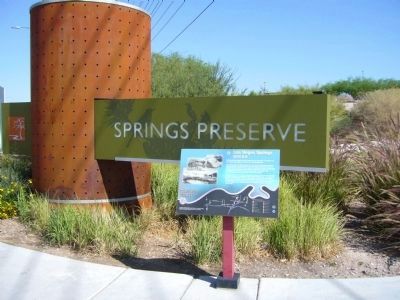
Regarding Las Vegas Springs. This site is Stop #1 on the Pioneer Trail. Noted on marker: The Pioneer Trail celebrates the early history of Las Vegas, offering a glimpse of the people and places that made Las Vegas thrive.
From the Pioneer Trail Brochure:
Much of the original historical facilities remain intact, and the site is now a cultural center with interpretive and educational exhibits. Portions of the Springs site are listed on the State and National Register of Historic Places.
Related markers. Click here for a list of markers that are related to this marker. The Pioneer Trail - West Las Vegas
Also see . . .
1. The Springs Preserve. The official website of the Preserve offers information, photos and history of the area. (Submitted on October 11, 2011.)
2. Website dedicated to the Las Vegas Pioneer Trail. HMdb.org is an awesome tool to provide information for the awesome sites of the Pioneer Trail. Visit the website to get additional information and learn more. (Submitted on October 31, 2020, by Deuce Brandt of North Las Vegas, Nevada.)
Credits. This page was last revised on February 7, 2023. It was originally submitted on October 4, 2011, by Bill Kirchner of Tucson, Arizona. This page has been viewed 1,228 times since then and 67 times this year. Last updated on December 28, 2011, by Michael Kindig of Elk Grove, California. Photos: 1, 2, 3. submitted on October 4, 2011, by Bill Kirchner of Tucson, Arizona. • Syd Whittle was the editor who published this page.


