Near Sharpesburg in Iredell County, North Carolina — The American South (South Atlantic)
William Sharpe
1742 - 1818
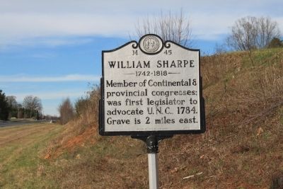
Photographed by Jamie Cox, December 26, 2011
1. William Sharpe Marker
Erected 1977 by Division of Archives and History. (Marker Number M-45.)
Topics and series. This historical marker is listed in these topic lists: Government & Politics • War, US Revolutionary. In addition, it is included in the North Carolina Division of Archives and History series list. A significant historical year for this entry is 1784.
Location. 35° 54.712′ N, 80° 57.131′ W. Marker is near Sharpesburg, North Carolina, in Iredell County. It is at the intersection of Wilkesboro Highway (State Highway 115) and Snow Creek Road on Wilkesboro Highway. Touch for map. Marker is in this post office area: Statesville NC 28625, United States of America. Touch for directions.

Regionally, this marker is in North Carolina’s Piedmont. It is also in the American South and specifically in the Upper South. Globally, it is in North America, the Western Hemisphere, the Western World, and the Anglosphere. Historically, it finds itself in what was once the territory of the Mississippian Culture,
this page online
Other nearby markers. At least 8 other markers are within 7 miles of this marker, measured as the crow flies: Clio's Nursery (approx. 1.3 miles away); Preserving the Past (approx. 6.9 miles away); Site of Fort Dobbs (approx. 6.9 miles away); a different marker also named Site of Fort Dobbs (approx. 7 miles away); Ebenezer Academy (approx. 7 miles away); James Hall (approx. 7 miles away); They found the fire very hot … February 27, 1760 (approx. 7 miles away); Anglo-Cherokee War (1759 - 1761) (approx. 7 miles away).
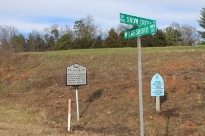
Photographed by Jamie Cox, December 26, 2011
2. William Sharpe Marker
Credits. This page was last revised on June 30, 2021. It was originally submitted on December 29, 2011, by Jamie Cox of Melbourne, Florida. This page has been viewed 907 times since then and 54 times this year. Photos: 1, 2. submitted on December 29, 2011, by Jamie Cox of Melbourne, Florida. • Craig Swain was the editor who published this page.
