Brule in Keith County, Nebraska — The American Midwest (Upper Plains)
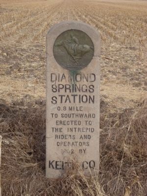
Diamond Springs Station
[Pony Express medallion on the top]
0.8 miles to southward
Erected to the intrepid riders and operators 1962 by Keith Co.
Erected 1962 by Keith County.
Topics and series. This historical marker is listed in this topic list: Communications. In addition, it is included in the Pony Express National Historic Trail series list. A significant historical year for this entry is 1962.
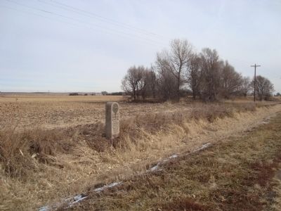
Location. 41° 5.455′ N, 101° 54.277′ W. Marker is in Brule, Nebraska, in Keith County. Marker is on U.S. 30. This marker is approximately 1 mile west of Brule on Highway 30. Touch for map. Marker is in this post office area: Brule NE 69127, United States of America. Touch for directions.
Other nearby markers. At least 8 other markers are within 10 miles of this marker, measured as the crow flies. Oregon Trail (approx. 3.4 miles away); California Hill (approx. 3.9 miles away); Purple Heart (approx. 7.8 miles away); Chain – O – Lakes (approx. 7.8 miles away); Samuel David “Lep” Sanders (approx. 9 miles away); The Pony Express (approx. 9.1 miles away); Phelps Hotel (approx. 9.1 miles away); Waterman Sod House (approx. 9.1 miles away). Touch for a list and map of all markers in Brule.
Also see . . .
1. Pony Express - Nebraska Stations. National Pony Express Association website entry (Submitted on January 1, 2012, by Barry Swackhamer of Brentwood, California.)
2. Pony Express. Wikipedia entry (Submitted on January 1, 2012, by Barry Swackhamer of Brentwood, California.)
Additional keywords. Pony Express
Credits. This page was last revised on September 3, 2021. It was originally submitted on January 1, 2012, by Barry Swackhamer of Brentwood, California. This page has been viewed 761 times since then and 19 times this year. Photos: 1, 2. submitted on January 1, 2012, by Barry Swackhamer of Brentwood, California. • Bill Pfingsten was the editor who published this page.

