Big Springs in Deuel County, Nebraska — The American Midwest (Upper Plains)
Waterman Sod House
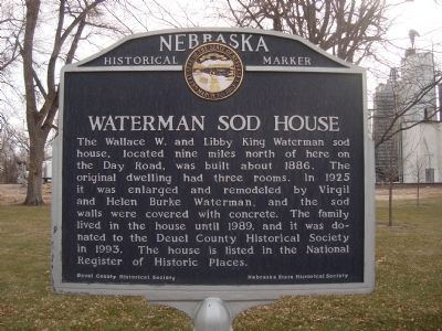
Photographed by Barry Swackhamer, December 12, 2011
1. Waterman Sod House Marker
Erected by Deuel County Historical Society/Nebraska State Historical Society. (Marker Number 383.)
Topics and series. This historical marker is listed in these topic lists: Notable Buildings • Settlements & Settlers. In addition, it is included in the Nebraska State Historical Society series list. A significant historical year for this entry is 1886.
Location. 41° 3.72′ N, 102° 4.513′ W. Marker is in Big Springs, Nebraska, in Deuel County. It is at the intersection of Railroad Street (State Highway 138) and Pine Street on Railroad Street. This marker is located in Railroad (Eiker) Park. Touch for map. Marker is in this post office area: Big Springs NE 69122, United
this page online

Regionally, this marker is in the Nebraska Panhandle. It is also in the American Midwest, in the Corn Belt, on the prairies, on the Great Plains, and specifically on the High Plains. Globally, it is in North America, the Western Hemisphere, the Western World, and the Anglosphere. Historically, it finds itself in what was once the Louisiana Purchase.
Other nearby markers. At least 8 other markers are within 5 miles of this marker, measured as the crow flies: Sam Bass and the Big Springs Robbery (here, next to this marker); Phelps Hotel (about 500 feet away, measured in a direct line); The Pony Express (about 500 feet away); The Lone Tree (about 600 feet away); The Big Spring (about 700 feet away); South Platte Station (approx. 4 miles away); Deuel County Nebraska (approx. 4.3 miles away); Keith County Nebraska (approx. 4.3 miles away). Touch for a list and map of all markers in Big Springs.
Also see . . . Wallace W. Waterman Sod House - Wikipedia. (Submitted on January 9, 2012, by Bill Pfingsten of Bel Air, Maryland.)
Additional keywords. sod house
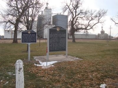
Photographed by Barry Swackhamer, December 12, 2011
2. Waterman Sod House Marker
Credits. This page was last revised on June 16, 2016. It was originally submitted on January 2, 2012, by Barry Swackhamer of Brentwood, California. This page has been viewed 1,308 times since then and 47 times this year. Photos: 1, 2. submitted on January 2, 2012, by Barry Swackhamer of Brentwood, California. • Bill Pfingsten was the editor who published this page.
