The Lone Tree
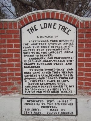
Landmark for Pony Express, Org. and Calif. Trails, Emigrants Overland Stage and railroads.
Evidence showed that Sam Bass gang after they heldup express train devided [sic] $60,000 and cooked their meal, this took place in 1877.
Known as Lovers Tree, children played under it, hit by lightning 3 times 1 year. Cut up for fire wood 1931-33.
Dedicated Sept. 18, 1985
Memorial to the Big Springs Pioneers.
Erected 1985.
Topics. This historical marker is listed in this topic list: Landmarks. A significant historical date for this entry is September 18, 1885.
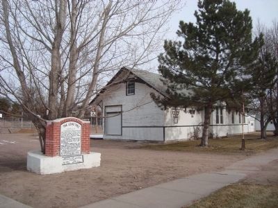
Location. 41° 3.792′ N, 102° 4.61′ W. Marker is in Big Springs, Nebraska, in Deuel County. It is on West Second Street. This marker is located on West Second Street, between Oak and Maple Streets. Touch for map. Marker is in this post office area: Big Springs NE 69122, United States of America. Touch for directions.
Regionally, this marker is in the Nebraska Panhandle. It is also in the American Midwest,
this page online
Other nearby markers. At least 8 other markers are within 5 miles of this marker, measured as the crow flies: The Big Spring (within shouting distance of this marker); Sam Bass and the Big Springs Robbery (about 600 feet away, measured in a direct line); Waterman Sod House (about 600 feet away); The Pony Express (about 600 feet away); Phelps Hotel (about 700 feet away); South Platte Station (approx. 3.9 miles away); Deuel County Nebraska (approx. 4.4 miles away); Keith County Nebraska (approx. 4.4 miles away). Touch for a list and map of all markers in Big Springs.
Credits. This page was last revised on June 16, 2016. It was originally submitted on January 2, 2012, by Barry Swackhamer of Brentwood, California. This page has been viewed 1,312 times since then and 76 times this year. Photos: 1, 2, 3, 4. submitted on January 2, 2012, by Barry Swackhamer of Brentwood, California. • Bill Pfingsten was the editor who published this page.
