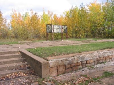
Kelly Lake near Hibbing in Saint Louis County, Minnesota — The American Midwest (Upper Plains)
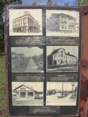
Business District
Many varieties of shops were available to satisfy the community's needs.
People came from the many small locations and other communities to shop in Hibbing.
Like any pioneer mining town, the men gathered in the saloons to socialize. Hibbing had 60 saloons, many of which were patronized by each ethnic nationality.
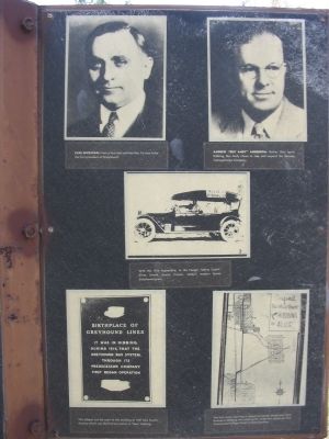
These are some scenes of the business district.
Topics. This historical marker is listed in these topic lists: Industry & Commerce • Settlements & Settlers.
Location. 47° 26.696′ N, 92° 56.39′ W. Marker is near Hibbing, Minnesota, in Saint Louis County. It is in Kelly Lake. Marker is on Lincoln Street east of 2nd Avenue North, on the left when traveling east. Marker can be reached from Greyhound Boulevard/3rd Avenue East. Touch for map. Marker is in this post office area: Hibbing MN 55746, United States of America. Touch for directions.
Other nearby markers. At least 8 other markers are within walking distance of this marker. Moving the Town (here, next to this marker); Frank Hibbing (here, next to this marker); Schools (here, next to this marker); Carnegie Library (here, next to this marker); Oliver Club (here, next to this marker); Finnish Workers Hall (within shouting distance of this marker); Oliver Mining Co. Headquarters / Oliver Shop Laboratory (about 700 feet away, measured in a direct line); Train Depot / Street Car Bridge (approx. ¼ mile away). Touch for a list and map of all markers in Hibbing.
Regarding Business District. The nearby Hull-Rust Mine began mining operations in 1896. The Village of Hibbing grew up near this mine pit. In 1918 all the buildings in the northern section of town were mounted on steel wheels and moved two miles to the south to make room for the mine's expansion.
Additional keywords. Old North Hibbing
Credits. This page was last revised on February 12, 2023. It was originally submitted on February 4, 2008, by Keith L of Wisconsin Rapids, Wisconsin. This page has been viewed 1,545 times since then and 19 times this year. Photos: 1, 2. submitted on February 4, 2008, by Keith L of Wisconsin Rapids, Wisconsin. 3, 4. submitted on February 5, 2008, by Keith L of Wisconsin Rapids, Wisconsin. • J. J. Prats was the editor who published this page.


