Summerton in Clarendon County, South Carolina — The American South (South Atlantic)
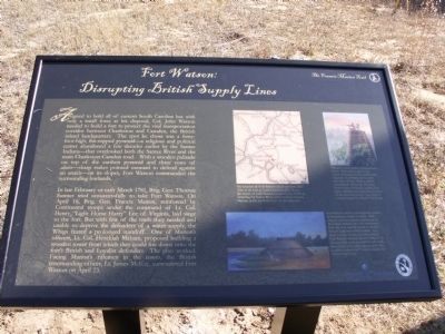
Fort Watson:
Disrupting British Supply Lines
In late February or early March 1781, Brig. Gen. Thomas Sumter tried unsuccessfully to take Fort Watson. On April 16, Brig. Gen. Francis Marion, reinforced by Continental troops under the command of Lt. Col. Henry “Light Horse Harry” Lee of Virginia, laid siege to the fort. But with few of the tools they needed and unable to deprive the defenders of a water supply, the Whigs feared a prolonged standoff. One of Marionís officers, Lt. Col. Hezekiah Maham, proposed building a wooden tower from which they could fire down onto the fortís British and Loyalist defenders. The plan worked. Facing Marionís riflemen in the tower, the British commanding officer, Lt. James McKay, surrendered Fort Watson on April 23.
Erected 2012 by Francis Marion Trail Commission of Francis Marion University.
Topics and series. This historical marker is listed in these topic lists: Forts and Castles • War, US Revolutionary. In addition, it is included in the Francis Marion Trail series list. A significant historical year for this entry is 1781.
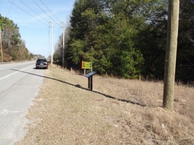
Location. 33° 31.819′ N, 80° 25.591′ W. Marker is in Summerton, South Carolina, in Clarendon County. Marker is on St. Paul Road (U.S. 301/15), on the right when traveling north. across the road from the entrance to the Santee National Wildlife Refuge. Touch for map. Marker is in this post office area: Summerton SC 29148, United States of America. Touch for directions.
Other nearby markers. At least 8 other markers are within 7 miles of this marker, measured as the crow flies. Fort Watson (approx. 0.4 miles away); 2nd Battle of Fort Watson (approx. 0.4 miles away); Swamp Fox (approx. 0.4 miles away); Santee National Wildlife Refuge (approx. 0.8 miles away); a different marker also named Fort Watson (approx. 0.8 miles away); Liberty Garden (approx. 3Ĺ miles away); Liberty Hill Church / Pioneers in Desegregation (approx. 4.7 miles away); Anne Custis Burgess (approx. 6.6 miles away). Touch for a list and map of all markers in Summerton.
Related markers. Click here for a list of markers that are related to this marker. To better understand the relationship, study each marker shown.
Photographed By Anna Inbody, January 8, 2012
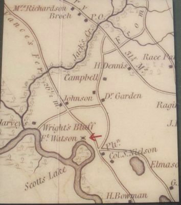
3. Map on the marker
The location of Fort Watson on a map from MillsĎ Atlas of the State of South Carolina (1825). Today, the waters of Lake Marion (created in the 1940s by damming the Santee River and named for Francis Marion) nearly reach the base of the structure.
Photographed By Anna Inbody, January 8, 2012
4. Picture on the marker
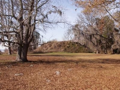
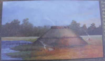
Fort Watson, from a contemporary mural in Summerton, South Carolina. Built atop an earthen pyramid abandoned by the Santee Indians, the fort overlooked both the river and the nearby road that linked Charleston with Camden. In a letter to Gen. Greene just after taking Fort Watson, Francis Marion called it “as strong a little post as could be well made, and on the most advantageous spot that could be wished for.” Courtesy Swamp Fox Murals Trail Society.
Photographed By Anna Inbody, January 8, 2012
5. Picture on the marker
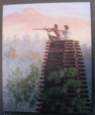
Mahamís tower, from a contemporary mural. Defenseless against the expert marksmen in this hastily-built structure, the British and Loyalist defenders of Fort Watson quickly surrendered. It was the first time Patriot forces in South Carolina had taken a British post since the invasion of the province nearly a year before. Courtesy Swamp Fox Murals Trail Society
Photographed By Anna Inbody, January 8, 2012
7. Siege of Fort Watson
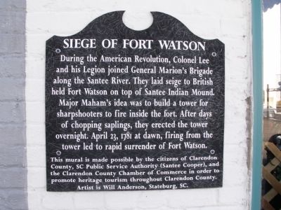
During the American Revolution, Colonel Lee and his Legion joined General Marion's Brigade along the Santee River. They laid siege to British held Fort Watson on top of Santee Indian Mound. Major Maham's idea was to build a tower for sharpshooters to fire inside the fort. After days of chopping saplings, they erected the tower overnight. April 23, 1781 at dawn, firing from the tower led to rapid surrender of Fort Watson.
This mural is made possible by the citizens of Clarendon County, SC Public Service Authority (Santee Cooper), and the Clarendon County Chamber of Commerce in order to promote heritage tourism throughout Clarendon County.
Artist is Will Anderson, Stateburg, SC.
This mural is made possible by the citizens of Clarendon County, SC Public Service Authority (Santee Cooper), and the Clarendon County Chamber of Commerce in order to promote heritage tourism throughout Clarendon County.
Artist is Will Anderson, Stateburg, SC.
Photographed By Anna Inbody, January 8, 2012
8. Fort Watson Marker
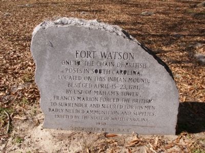
One of the Chain of British Posts in South Carolina. Located on this Indian Mound. Besieged April 15 - 23, 1781. By use of Maham's Tower, Francis Marion forced the British to surrender and secured for his men badly needed ammunition and supplies.
Erected by the state of South Carolina 1950
"Sponsored by S.C.D.A.R."
Credits. This page was last revised on June 16, 2016. It was originally submitted on January 9, 2012, by Anna Inbody of Columbia, South Carolina. This page has been viewed 2,615 times since then and 58 times this year. Photos: 1, 2, 3, 4, 5, 6, 7, 8, 9. submitted on January 9, 2012, by Anna Inbody of Columbia, South Carolina. • Craig Swain was the editor who published this page.
