
Near Pavo in Brooks County, Georgia — The American South (South Atlantic)
Bethel Primitive Baptist Church
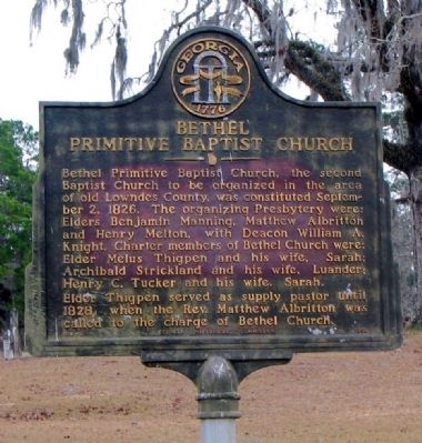
Photographed by David Seibert, January 10, 2005
1. Bethel Primitive Baptist Church Marker
Erected 1958 by Georgia Historical Commission. (Marker Number 014-8.)
Topics and series. This historical marker is listed in this topic list: Religion & Religious Structures. In addition, it is included in the Georgia Historical Society series list. A significant historical date for this entry is September 2, 1826.
Location. 30° 58.5′ N, 83° 37.883′ W. Marker is near Pavo, Georgia, in Brooks County. It is on Bethel Church Road 1½ miles south of Georgia Route 122, on the left when traveling south. Touch for map. Marker is in this post office area: Pavo GA 31778, United States of
this page online

Regionally, this marker is in Georgia’s Coastal Plain. It is also in the American South, specifically in the Deep South, and in the Wiregrass. Globally, it is in North America, the Western Hemisphere, the Western World, and the Anglosphere. Historically, it finds itself in what was once the territory of the Mississippian Culture, one of the original Thirteen Colonies, one of the Confederate States of America, and the Antebellum South.
Other nearby markers. At least 8 other markers are within 11 miles of this marker, measured as the crow flies: Old Coffee Road (approx. 5.1 miles away); Barney Colored Elementary School (approx. 7.2 miles away); a different marker also named Old Coffee Road (approx. 7.8 miles away); Mount Zion Camp Ground (approx. 7.9 miles away); The Old Morven School (approx. 8.2 miles away); a different marker also named Old Coffee Road (approx. 8.8 miles away); Greenfield Church (approx. 10.9 miles away); Olde Greenfield Church and Historic Cemetery (approx. 10.9 miles away).
Additional commentary.
1. Nearby unmarked 'slave' cemetery?
I've seen that marker since
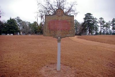
Photographed by David Seibert, January 18, 2011
2. Bethel Primitive Baptist Church Marker
A question... is there an unmarked 'slave' cemetery behind the other one?
Thanks for the info.
Editor's Note: Regrettably, we can't help answer this question. However, a future visitor to this page may be able to assist. Note To Editor only visible by Contributor and editor
— Submitted March 7, 2010, by Sheila Annette Johnson Fussell of Havana, Florida.
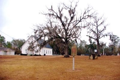
Photographed by David Seibert, January 18, 2011
3. Bethel Primitive Baptist Church and Marker
Credits. This page was last revised on January 26, 2020. It was originally submitted on December 27, 2008, by David Seibert of Sandy Springs, Georgia. This page has been viewed 4,528 times since then and 43 times this year. Last updated on January 11, 2012, by David Seibert of Sandy Springs, Georgia. Photos: 1. submitted on December 27, 2008, by David Seibert of Sandy Springs, Georgia. 2, 3. submitted on January 11, 2012, by David Seibert of Sandy Springs, Georgia. • Bill Pfingsten was the editor who published this page.
