Mariposa in Mariposa County, California — The American West (Pacific Coastal)
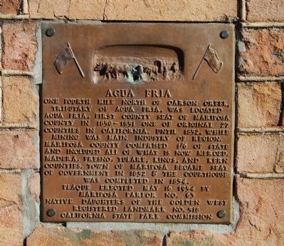
Agua Fria
Photographed by Barry Swackhamer, August 20, 2011
1. Aqua Fria Marker
Erected 1954 by Native Daughters of the Golden West Mariposa Parlor No. 63, and California State Park Commission. (Marker Number 518.)
Topics and series. This historical marker is listed in these topic lists: Government & Politics • Settlements & Settlers. In addition, it is included in the California Historical Landmarks, and the Native Sons/Daughters of the Golden West series lists. A significant historical year for this entry is 1852.
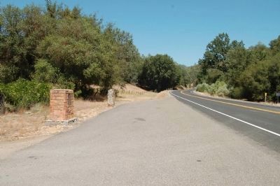
Location. 37° 28.866′ N, 120° 0.646′ W. Marker is in Mariposa, California, in Mariposa County. It is on State Highway 140 east of Yaqui Gulch Road, on the left when traveling east. Touch for map. Marker is at or near this postal
this page online

Regionally, this marker is in the Gold Country and in the Sierra Nevada. It is also in the American Mountain West. Globally, it is in North America, on the Pacific Rim, in the Western Hemisphere, in the Western World, and in the Anglosphere. Historically, it finds itself in what was once New Spain and also Mexico’s Alta California.
Other nearby markers. At least 8 other markers are within 3 miles of this marker, measured as the crow flies: A different marker also named Agua Fria (a few steps from this marker); The Townsite of Agua Fria California (approx. 0.6 miles away); Mariposa Cemetery (approx. 2.1 miles away); The Townsite of Agua Fria, California (approx. 2.2 miles away); Mariposa Museum and History Center (approx. 2.3 miles away); The Lind Homes (approx. 2.4 miles away); Mariposa County Court House (approx. 2.4 miles away); a different marker also named Mariposa County Court House (approx. 2.4 miles away). Touch for a list and map of all markers in Mariposa.
Regarding Agua Fria. In 1954 the former townsite was designated
Photographed by Barry Swackhamer, August 18, 2011
2. Aqua Fria Markers
Statement of significance:
One-quarter mile north of Carson Creek, a tributary of Agua Fria Creek, was located the town of Agua Fria, in 1850-51 the first county seat of Mariposa County. One of the original 27 counties in California, Mariposa County comprised one-sixth of the state — all of what is now Merced, Madera, Fresno, Tulare, Kings, and Kern Counties — until 1852, while mining was the main industry of region. The town of Mariposa became the seat of government in 1852, and the courthouse there was completed in 1854.
Credits. This page was last revised on August 4, 2026. It was originally submitted on August 23, 2011, by Barry Swackhamer of Brentwood, California. This page has been viewed 1,271 times since then and 55 times this year. Last updated on January 12, 2012, by Michael Kindig of Elk Grove, California. Photos: 1, 2. submitted on August 23, 2011, by Barry Swackhamer of Brentwood, California. • Syd Whittle was the editor who published this page.
