
St. Matthews in Calhoun County, South Carolina — The American South (South Atlantic)
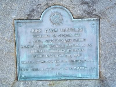
John Adam Treutlen
Photographed by Anna Inbody, January 15, 2012
1. John Adam Treutlen Marker
A stern Revolutionary patriot
Born at Berchtesgaden, Austria in 1726
Brutally murdered by Tories
about 1782 near this spot
Erected 1914 by William Thompson Chapter, D.A.R. and Emmily Geiger Chapter C.A.R. of St. Matthews, S.C.
Topics and series. This historical marker is listed in these topic lists: Government & Politics • Patriots & Patriotism • War, US Revolutionary. In addition, it is included in the Daughters of the American Revolution (DAR) series list. A significant historical year for this entry is 1777.
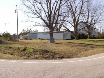
Location. 33° 36.16′ N, 80° 44.634′ W. Marker is in St. Matthews, South Carolina, in Calhoun County. It is at the intersection of Belleville Road (State Highway 9-45) and State Highway 601, on the right when traveling south on Belleville Road. Touch for map. Marker is at or near this postal address: 7146 Old State Rd, Saint Matthews SC 29135, United States of America. Touch for directions.

Regionally, this marker is in South Carolina’s Lowcountry, in Congaree Country, and specifically in Santee Cooper Country. It is also in the American South and specifically
this page online
Other nearby markers. At least 8 other markers are within 5 miles of this marker, measured as the crow flies: Tabernacle Cemetery (approx. 1.7 miles away); St. Peter AME Church and School (approx. 2.7 miles away); First Land Granted in Calhoun County Area (approx. 3.2 miles away); Honoring a Pioneer Woman (approx. 3.2 miles away); Robert E. Lee Memorial Highway (approx. 3.4 miles away); Shady Grove Church (approx. 4 miles away); Miller Cemetery (approx. 4.1 miles away); St. Matthew's Lutheran Church (approx. 4.3 miles away). Touch for a list and map of all markers in St. Matthews.
Photographed by Anna Inbody, January 15, 2012
2. Overview
Credits. This page was last revised on January 25, 2026. It was originally submitted on January 17, 2012, by Anna Inbody of Columbia, South Carolina. This page has been viewed 1,235 times since then and 57 times this year. Photos: 1, 2. submitted on January 17, 2012, by Anna Inbody of Columbia, South Carolina. • Craig Swain was the editor who published this page.
