
Schuylkill Township near Phoenixville in Chester County, Pennsylvania — The American Northeast (Mid-Atlantic)
Village of Valley Forge
Photographed by Keith S Smith, January 3, 2012
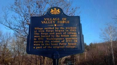
1. Village of Valley Forge Marker
This marker has been recently restored. Note the weld marks along the bottom and the clean paint. The placement organization name could not be repainted with the rest of the marker due to the repair. A PenDOT worker told me when snow is plowed into these markers in the bitter cold the castings often develop cracks and often break.
Also, the full moon is visible at the top right.
Village settled by the workers at iron forge begun in 1742. The forge and part of village were burned by the British army in 1777. Washington's quarters during the winter of 1777-78 were in the Isaac Potts' house, a part of the original village.
Erected 1947 by Pennsylvania Historical and Museum Commission.
Topics and series. This historical marker is listed in these topic lists: Industry & Commerce • Settlements & Settlers. In addition, it is included in the Pennsylvania Historical and Museum Commission (PHMC) series list. A significant historical year for this entry is 1742.
Location. 40° 6.003′ N, 75° 27.803′ W. Marker is near Phoenixville, Pennsylvania, in Chester County. It is in Schuylkill Township. It is at the intersection of Vally Forge Road (Pennsylvania Route 23) and Owen Road - Horseshoe Trail, on the right when traveling west on Vally Forge Road. Touch for map. Marker is at or near this postal address: 1080 Horse-Shoe Trail, Phoenixville PA 19460, United States of America. Touch for directions.

Regionally, this marker is in Southeast Pennsylvania and in Greater Philadelphia. It is also in the American
this page online
Other nearby markers. At least 8 other markers are within walking distance of this marker: Horse-Shoe Trail (about 400 feet away, measured in a direct line); To Honor the Maker of First American Flag (about 400 feet away); Honor Court to Brigadier General Lachlan McIntosh (about 400 feet away); George Washington’s Coffee Bean Tree (about 500 feet away); Valley Creek (about 600 feet away); Washington’s Headquarters (approx. 0.2 miles away); American Icon (approx. 0.2 miles away); War Comes to Valley Forge (approx. 0.2 miles away). Touch for a list and map of all markers in Phoenixville.
Another marker is no longer nearby. The Village of Valley Forge (was approx. 0.2 miles away but has been permanently removed).
Photographed by Keith S Smith, January 3, 2012
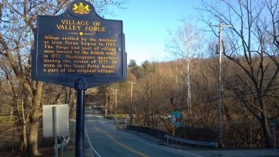
2. Village of Valley Forge Roadside Marker
Photographed by Keith S Smith, January 3, 2012
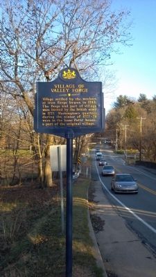
3. Village of Valley Forge Marker Facing East
Credits. This page was last revised on February 7, 2023. It was originally submitted on January 19, 2012, by Keith S Smith of West Chester, Pennsylvania. This page has been viewed 960 times since then and 23 times this year. Photos: 1, 2, 3. submitted on January 19, 2012, by Keith S Smith of West Chester, Pennsylvania. • Bill Pfingsten was the editor who published this page.
