Cape Girardeau in Cape Girardeau County, Missouri — The American Midwest (Upper Plains)
George Drouillard
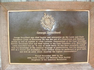
Photographed by Ken Smith, May 24, 2009
1. George Drouillard Marker
Erected 2005 by John Guild Chapter and Missouri State Society Daughters of the American Revolution.
Topics and series. This historical marker is listed in this topic list: Exploration. In addition, it is included in the Daughters of the American Revolution (DAR) series list.
Location. 37° 18.051′ N, 89° 31.122′ W. Marker is in Cape Girardeau, Missouri, in Cape Girardeau County. It can be reached from Water Street north of William Street, on the right when traveling north. Marker
this page online

Regionally, this marker is in Southeast Missouri. It is also in the American Ozarks, in the Lewis & Clark Corridor, in the Corn Belt, and in the Great River Road Region. Globally, it is in North America, the Western Hemisphere, the Western World, and the Anglosphere. Historically, it finds itself in what was once the territory of the Mississippian Culture, the Louisiana Purchase, and the Antebellum South.
Other nearby markers. At least 8 other markers are within walking distance of this marker: The Red House Interpretive Center (here, next to this marker); The Red House (here, next to this marker); The Lewis and Clark Expedition Across Missouri (a few steps from this marker); Old St. Vincent's Church (within shouting distance of this marker); B'nai Israel Synagogue (within shouting distance of this marker); Cape La Croix Creek (within shouting distance of this marker); Title Panel
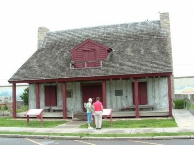
Photographed by Ken Smith, May 24, 2009
2. Red House Interpretive Center
Credits. This page was last revised on April 21, 2023. It was originally submitted on January 21, 2012, by Ken Smith of Milan, Tennessee. This page has been viewed 1,173 times since then and 51 times this year. Photos: 1, 2. submitted on January 21, 2012, by Ken Smith of Milan, Tennessee. • Craig Swain was the editor who published this page.
