Near Twin Oaks in Kern County, California — The American West (Pacific Coastal)
Walker Basin
Point of Historical Interest
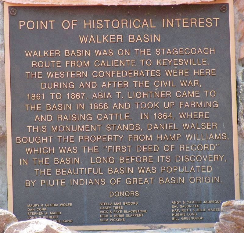
Photographed by Denise Boose, April 17, 2024
1. Walker Basin Marker
Walker Basin was on the stagecoach route from Caliente to Keyesville. The Western Confederates were here during and after the Civil War, 1861 to 1867. Abia T. Lightner came to the basin in 1858 and took up farming and raising cattle. In 1864, where this monument stands, Daniel Walser bought the property from Hamp Williams, which was the "First Deed of Record" in the basin. Long before its discovery, the beautiful basin was populated by Piute Indians of Great Basin origin.
Donors
Maury & Gloria Wolfe, Dan Cork, Stephen A Maier, John Guerrero, Annie Kaho, Stella Mae Brooks, Casey Tibbs, Vick & Faye Blackstone, Dick & Rubie Slappert, Slim Pickens, Andy & Camille Jaregui, Sal Salonites,Hap, Ruth & Julie Magee, Hughie Long, Bill Greenough
Erected by Cowboy Memorial and Library.
Topics. This historical marker is listed in this topic list: Settlements & Settlers. A significant historical year for this entry is 1861.
Location. 35° 24.048′ N, 118° 28.183′ W. Marker is near Twin Oaks, California, in Kern County. It is on Cow Boy Lane (Interstate 58) north of Walker Basin Road, on the left when traveling north. The Cowboy
this page online

Regionally, this marker is in California’s San Joaquin Valley, specifically in the Central Valley, and in the Sierra Nevada. It is also on the American Pacific Coast. Globally, it is in North America, on the Ring of Fire, on the Pacific Rim, in the Western Hemisphere, in the Western World, and in the Anglosphere. Historically, it finds itself in what was once New Spain and also Mexico’s Alta California.
Other nearby markers. At least 8 other markers are within 9 miles of this marker, measured as the crow flies: A different marker also named Walker Basin (within shouting distance of this marker); Rankin Ranch (approx. 4.9 miles away); Dedicated to Little Lucy and the Lightners (approx. 4.9 miles away); Piute Ranch Homesite of Elizabeth "Lizzie" McGuirk (approx. 5½ miles away); First Catholic Church and Cemetery in Kern County (approx. 8.3 miles away); Havilah (approx. 8.3 miles away); Stage Robbery! (approx. 8½ miles away); Historic Havilah
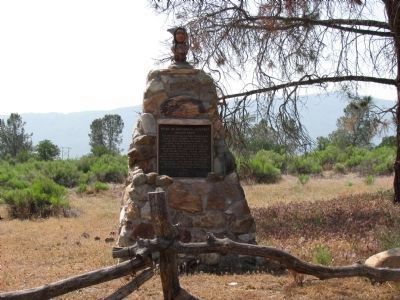
Photographed by Denise Boose, April 17, 2009
2. Walker Basin Marker
More about this marker. The Cowboy Memorial is closed permanently and is now part of the Z Ranch.
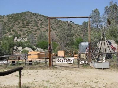
Photographed by Denise Boose, April 18, 2009
3. Cowboy Memorial and Library
Located on the right on Cowboy Lane, not far from the entrance.
Credits. This page was last revised on May 7, 2026. It was originally submitted on January 21, 2012, by Denise Boose of Tehachapi, California. This page has been viewed 1,170 times since then and 41 times this year. Photos: 1. submitted on May 16, 2024, by Denise Boose of Tehachapi, California. 2, 3. submitted on January 21, 2012, by Denise Boose of Tehachapi, California. • Syd Whittle was the editor who published this page.
