
Twin Oaks in Kern County, California — The American West (Pacific Coastal)
Walker Basin
Point of Historical Interest
Photographed by Denise Boose, April 17, 2024
1. Walker Basin Marker
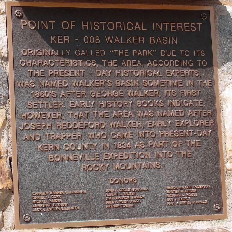
Originally called "The Park" due to its characteristics, the area, according to the present day historical experts, was named Walker's Basin, sometime in the 1860's after George Walker, its first settler. Early history books indicate, however, that the area was named after Joseph Reddeford Walker, early explorer and trapper, who came into present day Kern County in 1834 as part of the Bonneville Expedition into the Rocky Mountains.
Donors
Charles Warren Gillingham, Daniel C. Cork, Michael Haider, Lawerence E Snow, Jack & Evelyn Gilbraith, John & Cecile Goodman, Albert L Salyer, Jim & Sharon Manson, Fred & Ruby Doods, Arthur Tognini, Wanda Walser Thompson, Walter M Geisen, Richard C House, Bob J Everly, Paul & Gini de Fonville (Marker Number KER - 008.)
Topics. This historical marker is listed in this topic list: Settlements & Settlers. A significant historical year for this entry is 1834.
Location. 35° 24.007′ N, 118° 28.182′ W. Marker is in Twin Oaks, California, in Kern County. It is at the intersection of Walker Basin Road and Cowboy Lane, on the right when traveling west on Walker Basin Road. Touch for map. Marker
this page online

Regionally, this marker is in California’s San Joaquin Valley, specifically in the Central Valley, and in the Sierra Nevada. It is also on the American Pacific Coast. Globally, it is in North America, on the Ring of Fire, in the Pacific Rim, in the Western Hemisphere, in the Western World, and in the Anglosphere. Historically, it finds itself in what was once New Spain and also Mexico’s Alta California.
Other nearby markers. At least 8 other markers are within 9 miles of this marker, measured as the crow flies: A different marker also named Walker Basin (within shouting distance of this marker); Rankin Ranch (approx. 4.9 miles away); Dedicated to Little Lucy and the Lightners (approx. 4.9 miles away); Piute Ranch Homesite of Elizabeth "Lizzie" McGuirk (approx. 5½ miles away); First Catholic Church and Cemetery in Kern County (approx. 8.4 miles away); Havilah (approx. 8.4 miles away); Stage Robbery! (approx. 8.6 miles away); Historic Havilah (approx. 8.6 miles away).

Photographed by Denise Boose, April 17, 2036
2. Walker Basin Marker
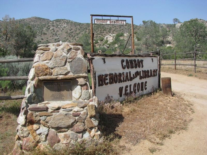
This marker was at the Cowboy Memorial and Library, now permanently closed.

Photographed by Denise Boose, April 18, 2009
3. Cowboy Memorial and Library
Inside the Cowboy Memorial and Library, now permanently closed.
Photographed by Denise Boose, April 17, 2009
4. Cowboy Memorial and Library
“Cowboy Memorial and Library, established
June 17, 1980. Dedicated to The Cowboys”
Credits. This page was last revised on May 7, 2026. It was originally submitted on January 21, 2012, by Denise Boose of Tehachapi, California. This page has been viewed 1,275 times since then and 70 times this year. Photos: 1. submitted on May 16, 2024, by Denise Boose of Tehachapi, California. 2, 3, 4. submitted on January 21, 2012, by Denise Boose of Tehachapi, California. • Syd Whittle was the editor who published this page.
