Fountain Springs in Tulare County, California — The American West (Pacific Coastal)
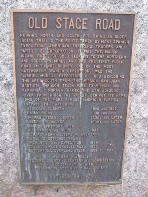
Old Stage Road
Jedediah S. Smith - 1826 & 1827
Ewing Young - 1830 and 1832
Thomas "Pedleg' Smith - 1830's and later
Joseph R. Walker - 1830's and later
John C. Fremont with Kit Carson as guide - 1844
Edward Kern, Joseph R. Walker as guide detached from Fremont's 3rd Expedition - 1846
Stockton~Los Angeles Road - 1853
Butterfield Overland Stage - 1858 to 1861
Erected 1978 by Tulare County Presidential Commission in Cooperation with Tulare County Historical Society.
Topics and series. This historical marker is listed in these topic lists: Exploration • Roads & Vehicles • Settlements & Settlers. In addition, it is included in the Butterfield Overland Mail series list. A significant historical year for this entry is 1806.
Location. 35° 53.559′ N, 118° 55.112′ W. Marker is in Fountain Springs, California, in Tulare County. Marker is at the intersection of Avenue 56 (County Route J22) and Old Stage Coach Road, on the right when traveling east on Avenue 56. Located to the right of the Fountain Springs Store/Bar/Restaurant. Touch for map. Marker is in this post office area: Porterville CA 93257, United States of America. Touch for directions.
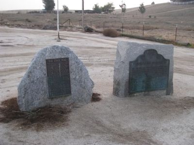
Other nearby markers. At least 8 other markers are within 11 miles of this marker, measured as the crow flies. Fountain Springs (here, next to this marker); "El Cojo" (within shouting distance of this marker); Tailholt (approx. 7 miles away); Dutch Corners (approx. 7.1 miles away); The Original Walker Pass (approx. 8 miles away); Garcés Baptismal Site (approx. 10.1 miles away); Welcome to the Tule River Indian-Reservation (approx. 10.4 miles away); Tule River Indian Reservation (approx. 10.4 miles away). Touch for a list and map of all markers in Fountain Springs.
Credits. This page was last revised on June 16, 2016. It was originally submitted on January 22, 2012, by Denise Boose of Tehachapi, California. This page has been viewed 1,387 times since then and 62 times this year. Photos: 1, 2. submitted on January 22, 2012, by Denise Boose of Tehachapi, California. • Syd Whittle was the editor who published this page.

