
Huntington Beach in Orange County, California — The American West (Pacific Coastal)
126 Main Street
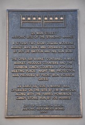
Historic Site of the Standard Market
Photographed by Michael Kindig, January 25, 2012
1. 126 Main Street Marker
The open air market contained a meat market, produce counters and the rainbow lunch counter, a popular meeting place. Night time protection was provided by front iron scissor gates.
As early as 1926, a market was operated on the site by J.W. McIntosh along with the Harris Homemade Candy Store, run by Joe Harris.
Erected 2000 by City of Huntington Beach, Historic Resources Board.
Topics. This historical marker is listed in these topic lists: Industry & Commerce • Notable Places. A significant historical year for this entry is 1926.
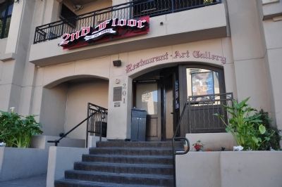
Location. 33° 39.473′ N, 118° 0.054′ W. Marker is in Huntington Beach, California, in Orange County. It is on Walnut Avenue, on the right when traveling south. Touch for map. Marker is at or near this postal address: 201 Walnut Avenue, Huntington Beach CA 92648, United States of America. Touch for directions.

Regionally, this marker is in Greater Los Angeles and in the Peninsular Ranges. It is also on the American Pacific Coast. Globally, it is in North America, on the Ring of Fire, in the Pacific Rim, in the Western Hemisphere, in the Western World, and in the Anglosphere. Historically, it finds itself in what was once New Spain and also Mexico’s Alta California.
Other nearby markers. At least 8 other markers are within 2 miles of this marker, measured as the crow flies: A different marker also named 126 Main Street (a few steps from this marker); Duke Kahanamoku (about 300 feet away, measured in a direct line); World's Largest Surfboard (about 500 feet away); Scout Cabin (approx. ¾ mile away); P-38 Memorial (approx. 1.1 miles away); Ode to Desert Storm (approx. 1.3 miles away); Auditorium and Tower (approx. 1.3 miles away); The Queen's Rose Garden
this page online
Photographed by Michael Kindig, January 25, 2012
2. 126 Main Street Marker
May 23, 2011
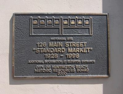
3. 126 Main Street - additional marker
In addition to the main marker on the Walnut Street side of the building, there is a smaller marker on the Main Street side.
May 23, 2011
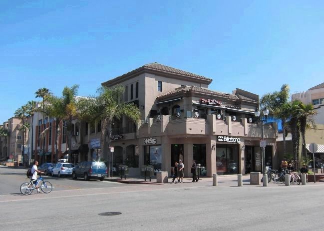
4. Wide view of 126 Main Street
The Main Street (additional) marker is visible here, just to the right of and below the "Billabong" sign, while the Walnut Street (main) marker is barely visible here, below and to the left of the "HSS" sign.
Credits. This page was last revised on June 16, 2016. It was originally submitted on January 25, 2012, by Michael Kindig of Elk Grove, California. This page has been viewed 916 times since then and 47 times this year. Photos: 1, 2. submitted on January 25, 2012, by Michael Kindig of Elk Grove, California. 3, 4. submitted on January 31, 2012. • Syd Whittle was the editor who published this page.
