Santa Barbara in Santa Barbara County, California — The American West (Pacific Coastal)
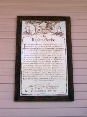
The Rochin Adobe
"1st day of October 1856, between the mayor and common council of the city of Santa Barbara of the first part and Jose Maria Rochin of the second part, for consideration of $30, Santa Barbara property. Signed Francisco Ruiz, presidente del concejo, and Antonio Maria de La Guerra, mayor."
On the 250' by 120' lot a three-room house was constructed of adobe bricks salvaged from the ruins of structures built against the southeast presidio wall.
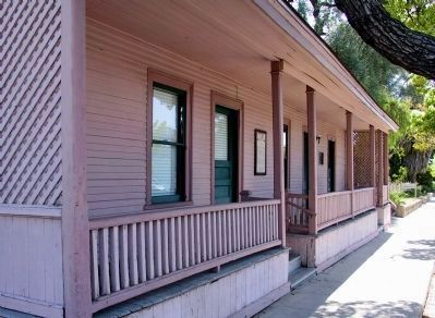
Originally build at an angle following the presidio walls, a portion of the porch was lost when the street was graded to the 1851 Haley survey specifications. Note that the porch roof overhang is still at the original angle. The rear section of the adobe and protective siding were added in 1901 by F.L Birabent, the son-in-law of Jose and Lorenza. The Rochin Adobe as remained in the family for 135 years. May it continue thus.
Erected 1988 by The Vituscan Missionaries of Platrix Chapter E Clampus Vitus.
Topics and series. This historical marker is listed in these topic lists: Notable Buildings • Settlements & Settlers. In addition, it is included in the E Clampus Vitus series list. A significant historical month for this entry is October 1856.
Location. 34° 25.338′ N, 119° 41.862′ W. Marker is in Santa Barbara, California, in Santa Barbara County. Marker is on Santa Barbara Street, on the right when traveling west. Touch for map. Marker is at or near this postal address: 820 Santa Barbara Street, Santa Barbara CA 93101, United States of America. Touch for directions.
Other nearby markers. At least 8 other markers are within walking distance of this marker. Rochin-Birabent Adobe (here, next to this marker); Santa Barbara Presidio (a few steps from this marker); Site of Royal Spanish Presidio (about 300 feet away, measured in a direct line); Casa Covarrubas (about 500 feet away); The Oreña Adobe (about 600 feet away); Jose Lobero's Opera House (about 700 feet away); De La Guerra Plaza (approx. 0.2 miles away); Hill-Carrillo Adobe (approx. 0.2 miles away). Touch for a list and map of all markers in Santa Barbara.
Credits. This page was last revised on June 16, 2016. It was originally submitted on January 27, 2012, by Michael Kindig of Elk Grove, California. This page has been viewed 660 times since then and 29 times this year. Photos: 1. submitted on January 27, 2012, by Michael Kindig of Elk Grove, California. 2. submitted on January 30, 2012, by Michael Kindig of Elk Grove, California. • Syd Whittle was the editor who published this page.

