Near Phippsburg in Sagadahoc County, Maine — The American Northeast (New England)
Fort Popham State Historic Site
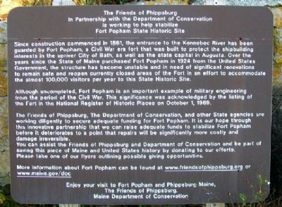
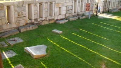
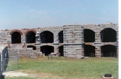
Since construction commenced in 1861, the entrance to the Kennebec River has been guarded by Fort Popham, a Civil War era fort that was built to protect the shipbuilding interests in the upriver City of Bath, as well as the state capital in Augusta. Over the years since the State of Maine purchased Fort Popham in 1924 from the United States Government, the structure has become unstable and in need of significant renovations to remain safe and reopen currently closed areas of the Fort in an effort to accommodate the almost 100,000 visitors per year to this State Historic Site.
Although uncompleted, Fort Popham is an important example of military engineering from the period of the Civil War. This significance was acknowledged by the listing of the Fort in the National Register of Historic Places on October 1, 1969.
The Friends of Phippsburg, The Department of Conservation, and other State agencies are working diligently to secure adequate funding for Fort Popham. It is our hope through this innovative partnership that we can raise adequate funds to stabilize Fort Popham before it deteriorates to a point that repairs will be significantly more costly and damage irreversible.
You can assist the Friends of Phippsburg and Department of Conservation and be part of saving this piece of Maine and United States history by donating to our efforts. Please take one of our flyers outlining possible giving opportunities.
More information about Fort Popham can be found at www.friendsofphippsburg.org or www.maine.gov/doc
Enjoy your visit to Fort Popham and Phippsburg, Maine.
Erected by The Friends of Phippsburg and Maine Department of Conservation.
Topics. This historical marker is listed in these topic lists: Forts and Castles • War, US Civil. A significant historical month for this entry is October 1896.
Location. 43° 45.197′ N, 69° 47.035′ W. Marker is near Phippsburg, Maine, in Sagadahoc County. Marker is along the coastal trail, about 500 feet south of Fort Popham State Historic Site, off Popham Road (Maine Route 209). Touch for map. Marker is in this post office area: Phippsburg ME 04562, United States of America. Touch for directions.
Other nearby markers. At least 8 other markers are within 10 miles of this marker, measured as the crow flies. Sites of Forts in this Area (about 600 feet away, measured in a direct line); Percival P. Baxter (about 600 feet away); Forts on the Kennebec River (about 600 feet away); Firing a Cannon (about 700 feet away); The Casemate Key to a Fort's Design (about 700 feet away); Fort Popham: Guardian of the Kennebec (about 700 feet away); Phippsburg Veterans and Mariners Memorial
(approx. 4.3 miles away); The Caulkers' Shed (1899) (approx. 9.9 miles away). Touch for a list and map of all markers in Phippsburg.
More about this marker. A second marker is located just inside the fort entrance.
Also see . . .
1. Fort Popham State Historic Site. (Submitted on January 31, 2012, by William Fischer, Jr. of Scranton, Pennsylvania.)
2. Fort Popham, Maine. (Submitted on January 31, 2012, by William Fischer, Jr. of Scranton, Pennsylvania.)
Credits. This page was last revised on November 2, 2020. It was originally submitted on January 31, 2012, by William Fischer, Jr. of Scranton, Pennsylvania. This page has been viewed 1,157 times since then and 46 times this year. Photos: 1. submitted on January 31, 2012, by William Fischer, Jr. of Scranton, Pennsylvania. 2. submitted on February 3, 2012, by William Fischer, Jr. of Scranton, Pennsylvania. 3. submitted on January 31, 2012, by William Fischer, Jr. of Scranton, Pennsylvania. 4. submitted on February 3, 2012, by William Fischer, Jr. of Scranton, Pennsylvania. 5, 6. submitted on January 31, 2012, by William Fischer, Jr. of Scranton, Pennsylvania. 7. submitted on January 31, 2012, by Mike Stroud of Bluffton, South Carolina.
